Fun westerly swell episode with favourable winds
South Australian Surf Forecast by Craig Brokensha (issued Monday December 4th)
Best Days: Mid Coast tomorrow afternoon, Wednesday morning, Thursday, Friday morning, South Coast tomorrow morning, Wednesday morning and Friday morning
Features of the Forecast (tl;dr)
- Moderate sized, inconsistent W/SW groundswell building tomorrow, holding Wed, with a reinforcing mid-period pulse Thu, easing Fri
- Local offshore winds tomorrow with weak sea breezes, back to the S/SE late in the gulf
- E/SE winds on the Mid Wed AM, E-E/NE down South ahead of gusty sea breezes
- Gusty S/SE winds Thu
- E/SE winds on the Mid Fri AM, E/NE down South ahead of gusty sea breezes
- Freshening S/SE winds Sat, stronger S/SE on Sun kicking up a localised, stormy windswell
Recap
Poor surf for the weekend with small to tiny waves and onshore winds Saturday across the South Coast, slightly better yesterday with the magnets offering the odd set for the desperate.
The Mid Coast was effectively flat.
This week and next (Dec 5 - 10)
The coming week looks workable for the South Coast thanks to generally persistent winds from the eastern quadrant, but the gulf will be the pick of the regions thanks to a good run of westerly swell.
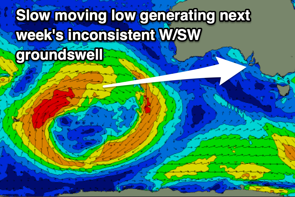
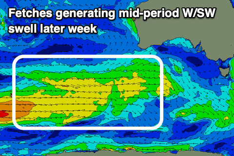
The swell has and is still being generated by initially, a strong, slow moving low through the southern Indian Ocean and now weaker frontal activity south-west and under Western Australia, today and tomorrow.

The more distant low has produced the groundswell which will be least consistent, arriving through tomorrow and building to 2ft+ by later in the day, holding 2ft most of Wednesday.
The trailing, weaker but closer frontal activity should maintain fun 2ft sets on Thursday on the favourable parts of the tide, coming in with a little more consistency, with easing surf from 1-2ft on Friday.
The South Coast will be slow and smaller thanks to the westerly swell direction and blocking effects of Kangaroo Island, with slow 2-3ft sets later tomorrow across Middleton, holding Thursday before easing Friday.
Now, local winds tomorrow will vary as a trough passes across the region this afternoon and evening, bringing S/SW winds that will quickly revert back to local offshore winds tomorrow morning. Afternoon sea breezes aren't due to be especially strong, with offshore S/SE winds due late across the Mid Coast.

Wednesday looks favourable for both coasts again with E/SE winds on the Mid Coast, E/NE-E down South, giving into gusty sea breezes. Thursday unfortunately looks unfavourable for the South Coast with S/SE winds holding, SE across the Mid Coast and variable into the afternoon across the gulf.
Friday as the swell starts easing should see winds tend E/NE again down South, E/SE on the Mid Coast before S'ly winds kick in.
Come the weekend, the troughy local weather leading to varying winds this week will give way to the eastern edge of a high pressure system, bringing fresh S/SE winds on Saturday, strengthening Sunday kicking up some new, localised, stormy S/SE windswell.
Unfortunately there'll be no size for the Mid Coast, while a good S/SW groundswell will be spoilt by these winds across the South Coast, generated by a strong polar low on the weekend.
Longer term onshore winds look to dominate the South Coast outlook from the southern quadrant but we'll have a closer look at this on Wednesday.


Comments
Thanks for the forecast update. I live in the SE and today was one of the days when the southern ocean here was flat. Yes it is mostly shit and windy but hardly ever without some sort of swell/swill even if it is from the friggin south east which it or the wind has been for the last month. Spring ? F##k it. Anyway it is a nice warm day, good for fishing close in but the purpose of this comment is the current KI wave buoy readings (1730). Wow. Peak period of around 4 seconds and the sea breeze coming in at 7s and some mystery movement at 10s. All of this assuming the paleys haven’t clouded my interpretation. Have a good one.
Yep, mental readings on the buoy eh! New swell is arriving though.