Here comes the wind (and the swell)
South Australian Surf Forecast by Ben Matson (issued Friday 29th July)
Features of the Forecast (tl;dr)
- Windy, easing swells this weekend, best options at Victor
- A whole week of stormy action on the Mid to pick and choose from (Mon onwards)
- Options on the metro beaches Mon, Wed, Thurs and Fri
- Small and clean (tho' blustery) next week at Victor
Recap
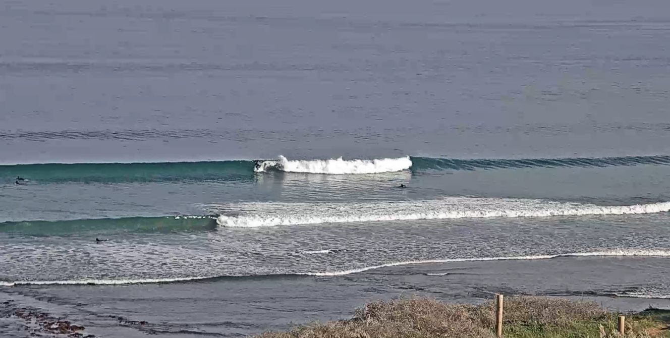
A new swell built Thursday, and has held today with clean 2ft+ groundswell lines on the Mid under a light offshore flow (see below, from late morning), with 3-4ft surf down south under similarly clean conditions. Hope you got some!

This weekend (July 30 - 31)
Freshening northerly winds will wipe out surf prospects on the Mid on Saturday, along with a rapidly easing swell. There’ll still be some small leftovers, and we may see a brief window of workable conditions at dawn, but with slow 1-2ft sets at best and a threatening strong northerly on the cards, you’ll be best off heading to Victor.
The swell trend will also be easing here, but conditions will remain clean all day and the swell magnets should light up with some really nice surf. Expect early 2-3ft sets at Middleton down to 1-2ft by the afternoon.
Wave heights will bottom out on Sunday, with very small options across the Middleton to Goolwa stretch under strengthening NW winds ahead of a late W’ly change.
A small increase in local windswell and small W'ly swell is possible on the Mid on Sunday, however we need two things to occur for there to be surfable options: (1) winds to be more than 25kts, and - under a pre-frontal pattern - (2) wind direction to be at least NW, preferably W/NW.
If this occurs, then we could see anything from 2ft windswell up to 4ft of storm surf. The former is the more likely solution into the afternoon, but either way, it’ll cold, wet, windy and very ordinary.
Next week (Aug 1 onwards)
Batten down the hatches!
An extended conveyer belt of cold fronts will provide a week of stormy action for the Mid, beginning Monday with initial W/NW winds and a mix of W’ly swell (3ft) and local windswell (3ft), the combination of which should see surf size pushing 3-4ft+ at the Mid’s swell magnets, and even some small waves on the metro beaches.
Another advancing front will straighten the winds around to the north on Tuesday morning ahead of a couple of NW blows through Wednesday and Thursday, maybe even early Friday, before we see the backside of this pattern and gusty SW winds kick in at the end of next week.
Surf size will ebb and flow in sync with the local wind, but shouldn’t drop below a background 2-3ft of groundswell, in fact the Wed/Thurs paten should push back up into the 4ft range, with possibly more local windswell noise on top.
It’s just your classic winter stormy pattern with plenty of small local metro waves if you’re interested.
Victor will see good, albeit blustery conditions for much of the week however the acute W’ly swell direction will be heavily attenuated by Kangaroo Island, which will limit size across most coasts and force surfing options around to the swell magnets.
There’s no major change expected in this pattern for the super long term pattern either, so buckle up - its a cold, windy couple of weeks ahead.
See you Monday!


Comments
So what's the go Monday down south?