Best over the coming days
South Australian Surf Forecast by Craig Brokensha (issued Monday December 20th)
Best Days: This afternoon on the Mid Coast, both coasts tomorrow morning, Mid Coast Wednesday, Mid Coast for the keen Thursday, Friday morning South Coast
Features of the Forecast (tl;dr)
- Moderate sized, mid-period SW swell for later today and tomorrow with variable tending W/SW then SW winds on the Mid, light W/NW tending S/SW down South
- Larger mix of swells building Wed, peaking later with mod-fresh S/SE winds
- Easing S/SW swell Thu with gusty SE tending S/SE winds
- Easing S/SW swell Fri with E/NE tending SE winds
- Poor weekend with fresh S/SE winds Sat, stronger from the S/SE Sun
Recap
A little bit of swell to 1-1.5ft on the Mid Coast Saturday but with bumpy/choppy conditions, tiny and onshore down South with a lighter onshore breeze.
Our inconsistent W/SW groundswell for yesterday provided more size across both coasts but winds were again not ideal with a general onshore flow and bumpy conditions
Today we've got our more consistent mid-period W/SW swell from a front moving through yesterday with bumpy, workable waves to 2ft on the Mid Coast and 3ft across Middleton down South, best in protected spots. A strong front that's passing under us today should bring more size to the South Coast this afternoon but with strengthening SW winds. The Mid should also kick to 2-3ft with the incoming tide and winds won't be too much of an issue.

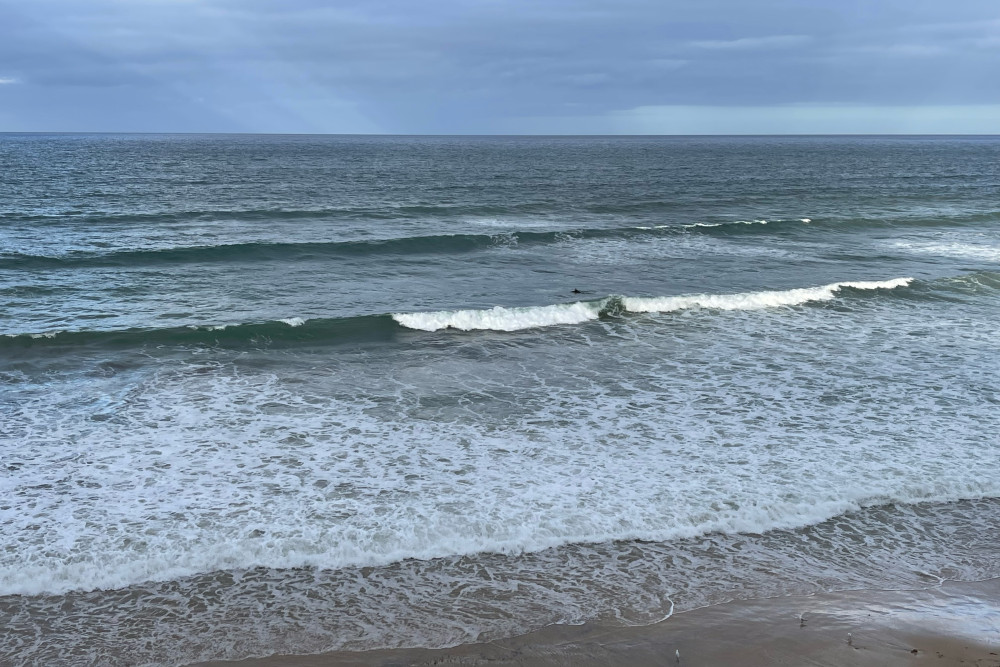
Bumpy, empty waves this AM
This week and weekend (Dec 21 – 26)
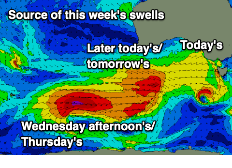
A strong frontal progression is currently moving under the country with multiple embedded fetches of gale-force winds.
The progression kicked off over the weekend with an initial strong, polar low generating gale to severe-gale W/SW winds in our medium-range swell window. As this low weakened, strong mid-latitude fronts fired up ahead of it, with the first moving through yesterday, bringing today's pulse of swell.
A secondary stronger front is now pushing under us, bringing strong to gale-force W-W/NW winds.
 This will bring a further increase in mid-period SW swell for this afternoon and tomorrow morning, coming in at 3ft+ across Middleton (4ft Goolwa), with the Mid Coast holding that 2ft range on the sets working the favourable parts of the tide.
Winds are looking favourable for both coasts and variable early on the Mid before shifting light to moderate W/SW, stronger into the afternoon. The South Coast should see light W/NW winds, then shifting S/SW later morning and into the afternoon.
Moving into Wednesday we're due to see some of the stronger groundswell energy filling in from the polar low, with a further increase in size due through the day, with a peak in size due late in the day/overnight.
The Mid Coast looks to persist around 2ft on the favourable parts of the tide with Middleton building to 4-6ft late in the day (smaller 4ft or so in the morning).
We'll then see the energy easing into the end of the week from 1-1.5ft on the Mid Thursday and 4-5ft across Middleton down South.
Unfortunately a high moving in from the west, bringing tomorrow's S/SW-SW change will continue to fill in Wednesday, bringing S/SE breezes to all locations, which will favour the Mid Coast. Fresher SE tending S/SE winds are due Thursday as the swell eases with Friday offering better E/NE winds down South with easing sets from 3ft across Middleton. The Mid Coast will become tiny.
Aanother trough will move through Friday evening, followed by a high, swinging winds back to the S/SE on Saturday, becoming stronger from the S/SE on Sunday as an the trough deepens inland across the south-east of the country.
This will create poor conditions with a junky S/SE windswell and no noticeable groundswell.
It looks like winds will persist out of the south-eastern quadrant through early-mid next week, improving from Thursday but with no decent size due to the blocking effects of the high. More on this Wednesday and in the meantime make the most of the current swells.

