Plenty of swell inbound but winds are an issue
South Australian Forecast by Craig Brokensha (issued Wednesday 2nd October)
Best Days: Mid Coast keen surfers tomorrow, Friday morning swell magnets South Coast, Mid Coast Saturday, South Coast protected spots Sunday
Recap
Flat conditions on the Mid Coast and improving waves down South as offshore winds straightened up through the day and the swell eased from 3ft on the sets off Middleton.
Today the swell was tiny off Middleton but super clean and good at Waits and Parsons.
This week and weekend (Oct 3 - 6)
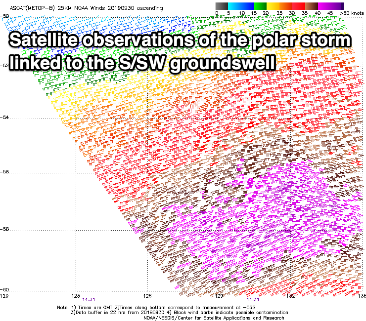
It's a pity a change due later today will leave onshore W/SW-SW winds across the South Coast tomorrow morning, as a new S/SW groundswell will fill in, providing good sized sets on the coast.
 The source of this swell was a strong polar low forming late in our swell window, with good 3ft sets due across Middleton. Winds may ease mid-morning while tending S/SW in direction.
The Mid Coast looks dicey with a dawn SW'ly tending variable ahead of sea breezes, but only a tiny inconsistent W/SW swell to 1-1.5ft on the sets.
Friday is looking much better but the swell will be on a quick decline. Middleton may see 1-2ft sets, better at Waits and Parsons with a fresh NE breeze, shifting S/SE as a trough moves across us.
Later in the day we might see our new inconsistent W/SW groundswell filling in, with a peak due Saturday.
The storm generating this swell has broken down south-west of WA, but as talked about on Monday, before this a great fetch of severe-gale W/SW winds were generated in our far western swell window.
The swell will be very inconsistent but should provide good 2ft sets on the favourable parts of the tide across the Mid Coast, 3-4ft along the Middleton to Goolwa stretch, though winds look a little dicey. A variable SE breeze may be seen on the South Coast, but conditions will remain average, much better on the Mid Coast.
Sunday looks cleaner but windy on the South Coast with a strong NW tending W/NW breeze, easing later in the day as a mid-latitude low moves across us. The Mid Coast will be poor with the onshore breeze.
Overnight Sunday the mid-latitude low will move across us, leaving SW winds into Monday with easing levels of swell across both coasts (1ft Mid Coast and 2ft+ Middleton).
Behind the weak mid-latitude low a series of broad but relatively weak polar fronts will develop south of WA and project towards Tasmania, generating some fun mid-period S/SW swell for Tuesday/Wednesday. Winds look dicey though and from the south-eastern quadrant, but we'll have to review this again on Friday.

