Strong S/SW groundswell to end the week, with a large W/SW groundswell Sunday PM
South Australian Forecast by Craig Brokensha (issued Wednesday 23rd May)
Best Days: Keen surfers Thursday morning, Friday, Saturday morning swell magnets, both coasts later Sunday
Recap
Tiny leftover windswell waves on the Mid Coast yesterday with onshore winds, cleaner down South with W'ly winds and fun options in protected spots with an easing S/SW groundswell.
Today the Mid Coast was clean but tiny, while the South Coast saw a new S/SW groundswell but with moderate onshore winds. Still it's workable across selected spots if you're not fussy.
Today’s Forecaster Notes are brought to you by Rip Curl
This weekend and next week (May 24 – 27)
 Today's S/SW groundswell will start to ease through this afternoon and drop back further tomorrow morning from the 3ft range off Middleton with a light variable E wind. This will create OK but not amazing conditions.
Our new long-period S/SW groundswell for tomorrow afternoon/evening and Friday morning has started to be generated by a strong low that's currently south-southwest of us.
Satellite observations from last night have already picked up 50kt core winds, and we'll see this system projecting towards and under Tasmania while strengthening today. This will see a fetch of storm-force S/SW winds directed in our southern swell window until early tomorrow, when the storms moves out of our swell window.
We should see a strong long-period S/SW groundswell arriving tomorrow afternoon and kicking to 3-4ft across Middleton by dark, with a peak likely Friday morning more to 4-5ft off Middleton at dawn, easing rapidly through the day owing to the low moving away from us.
Winds look good and out of the NE tending N/NE, favouring most of the coast (Goolwa more than Middleton) while Saturday will be great for the magnets with small easing sets from 2ft or so under a fresh and gusty N/NE offshore.
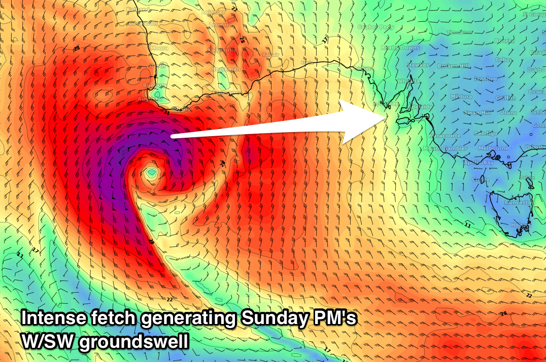
Into Sunday we're due to see a new acute W'ly swell building across both coasts, created by a severe low forming off the south-west tip of WA.
 Current forecasts have severe-gale to storm-force W'ly winds projected through our western swell window, weakening as the low pushes east through the Bight.
A large acute W/SW groundswell will be produced with it due to arrive Sunday and kick to a solid 3-4ft on the Mid Coast through the afternoon, with a late kick down South to 2-3ft off Middleton.
With the low weakening and dipping south-east Sunday we could see winds tending variable across the Mid Coast as the swell kicks (NW most of the day), while the South Coast will be clean.
Longer term we'll see more activity from the west under WA, and long-range long-period groundswells through next week with varying winds, but more on this Friday.

