Fun, inconsistent groundswell tomorrow
Eastern Tasmania Surf Forecast by Craig Brokensha (issued Monday 12th July)
Best Days: Tomorrow, early Wednesday for the keen, south magnets Thursday
Features of the Forecast (tl;dr)
- Inconsistent E/SE groundswell for tomorrow with fresh NW winds, easing Wed with mod N/NW-NW winds
- Small S'ly swell for Thu with strengthening N/NW winds
- Small SE swell building Sun, peaking Mon
Recap
Nothing too much Saturday but since later yesterday and through this morning we've got a good, inconsistent NE swell from a deep Tasman Low that formed off the Sydney region.
This week and weekend (Jul 13 - 18)
The NE swell from the Tasman Low will fade tomorrow but we've got our new, inconsistent E/SE groundswell due to take its place.
 This was generated over the weekend, south-east of New Zealand by a strong polar low, with a fetch of gale to severe-gale SE winds projected temporarily towards us.
The long travel distance will result in inconsistent sets but we should see strong, long-lined 3ft sets when they come, easing through Wednesday from 2ft to possibly 3ft.
Winds will be favourable for most locations with a fresh and persistent NW breeze tomorrow, lighter Wednesday and N/NW-NW.
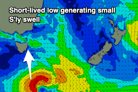
As the E/SE groundswell fades, a small, flukey pulse of S'ly swell may be seen Thursday, generated by a small, short-lived low firing up through our swell window tomorrow evening.
 A fetch of strong to gale-force S'ly winds will be generated, with the swell due to come in around a small 2ft or so on the south magnets Thursday with strengthening N/NW winds.
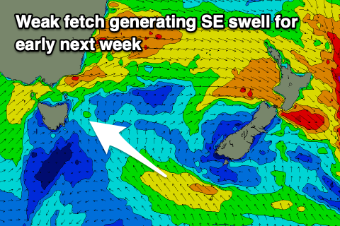
The swell will fade Friday and into the weekend we're looking at a small increase in weak SE swell from a broad though unconsolidated low developing east of us Saturday.
A weak fetch of SE winds are due to be projected towards us slightly on Saturday and Sunday, producing a small spike in SE swell Monday to 2-3ft or so. Conditions at this stage look favourable for this swell, but we'll have a closer look at this on Wednesday.

