Long Wave Trough brings south swells
Eastern Tasmania Surf Forecast by Craig Brokensha (issued Wednesday 13th January)
Best Days: Sunday onwards
Features of the Forecast (tl;dr)
- Small N/NE windswell building tomorrow PM but with NE winds
- New S'ly swell episode from Sun through all of next week, likely largest Tue
Recap
A good kick in N/NE swell yesterday and above expectations with 2-3ft sets with offshore winds ahead of a strong S/SE change. Today there's nothing left with the swell source leaving the building yesterday morning.
This week and weekend (Jan 14 - 17)
The models are picking up a spike in N/NE swell tomorrow, but looking at the swell generating fetch it looks too short-lived, positioned away from us though strong for a short period. It's unlikely we'd see much over 2ft across north-east swell magnets through the afternoon, tiny Friday.
Winds will swing from SW to NE, initially favouring the magnets, then onshore.
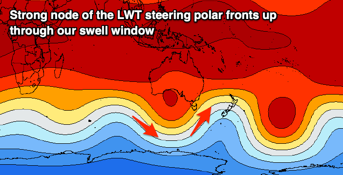
We then look ahead to the S'ly swell episode due from Sunday through most of next week. This will be the result of a strengthening node of the Long Wave Trough moving in from the west over the coming days, slowing down once moving into the Tasman Sea and across New Zealand early next week.

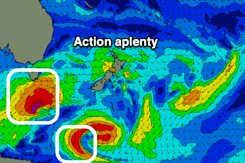
A flurry of strengthening polar fronts will be steered up through our southern swell window from the weekend through next week, with the first projecting strong to at times, gale-force SW winds past the south-east corner of the state on Saturday afternoon through Sunday morning.
A fun pulse of S'ly swell is due from this front on Sunday to 3ft on the south swell magnets with a W/NW tending W/SW breeze.
 This swell will ease temporarily into Monday from 2-3ft, but a much stronger polar storm is forecast to develop under the state, projecting severe-gale to storm-force SW winds south-east and then up past us through the day.
This looks to produce a larger S'ly groundswell for Tuesday, though the size is still a little in the air. Somewhere between 4-6ft looks most likely at this stage along with SW tending S/SE winds.
Following this, broader, though weaker frontal activity through the Tasman Sea and south of it should continue to generate plenty of S'ly tending S/SE swell through the end of the week as local winds relax, likely offshore each morning ahead of NE sea breezes. We'll look at this closer Friday though.

