Fading N/NE swell, slow till late next week
Eastern Tasmania Surf Forecast by Craig Brokensha (issued Friday 13th November)
Best Days: Early tomorrow, late next week
Recap
Building N/NE swell energy yesterday from 3-4ft in the morning to 4-5ft on the sets into the afternoon with northern corners the pick out of the wind.
With the swell producing fetch moving away the size has eased back today leaving less consistent but cleaner 2-3ft waves across the region.
This weekend and next week (Nov 14 - 20)
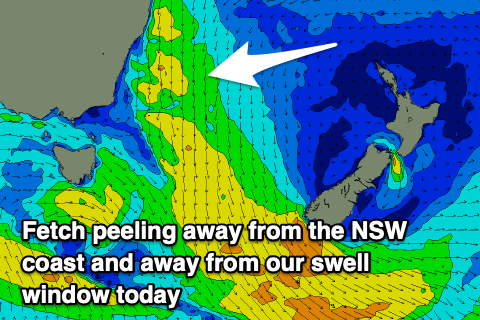
The swell generating fetch from this week has continued to retreat away from us, peeling away east off the southern NSW coast and with this we'll see the swell continuing to drop in size and consistency tomorrow.
 Infrequent, leftover 2ft sets are due across north-east swell magnets, tiny into Sunday.
Winds tomorrow morning should be out of the W/NW with sea breezes forming from about a line south of Chain of Lagoons, if not variable.
Into Monday, a brief burst of N/NE winds ahead of a strengthening cold front looks unlikely to generate any significant swell over 1-1.5ft and with morning variable winds, strengthening from the W/NW into the afternoon.
The surf will then go flat in the wake of the zonal frontal activity ahead of a new N/NE windswell event building Thursday and easing Friday. This will be as a strong mid-latitude front pushes in from the west against a high in the Tasman, but more on this Monday. Have a great weekend!

