Small north followed by south
Eastern Tasmania Surf Forecast by Craig Brokensha (issued Friday 4th September)
Best Days: Tuesday afternoon, Thursday and Friday south swell magnets
Recap
A small mix of S'ly and NE swells, cleanest in northern corners yesterday, tiny and average today.
This weekend and next week (Sep 5 - 11)
The weekend looks void of any major swells with any windswell from today due to fade, remaining tiny into Sunday.
 Our N/NE followed by S'ly swells for next week are on track with a cold front moving in from the west due to squeeze a strong high in the Tasman Sea, directing strengthening N/NE winds through our swell window Monday before swinging more N/NW Tuesday.
The fetch isn't expected to extend down quite as far but we should see a small 2ft to possibly 3ft of N/NE windswell for Tuesday across north swell magnets as winds shift from the N/NW to W/NW later afternoon. This will be the best time to surf with average, wind affected waves in the morning.
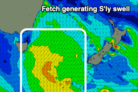
The cold front is due to spawn a small low pressure centre, with it projecting a weak fetch of strong S/SW winds up past us Wednesday.
A small, weak S'ly swell is due from this, building later Wednesday and peaking Thursday to 3ft across the south swell magnets, then easing. Winds look light W'ly ahead of N/NE sea breezes, favouring the south swell magnets.
The swell will ease Friday out of the S/SE and following this there's nothing significant on the cards at all. Have a great weekend!

