Upgrade in S'ly swell due late week, large swell next week
Eastern Tasmania Surf Forecast by Craig Brokensha (issued Wednesday 19th September)
Best Days: Late Friday south swell magnets and early Saturday, Monday morning, then Wednesday through Friday
Recap
Tiny yesterday with a weak N/NE windswell, while a possible slightly better NE swell due today wasn't really evident this morning, but could of pulsed a little through the day. In any case it was a very flukey source.
Today’s Forecaster Notes are brought to you by Rip Curl
This week and weekend (Sep 20 – 23)
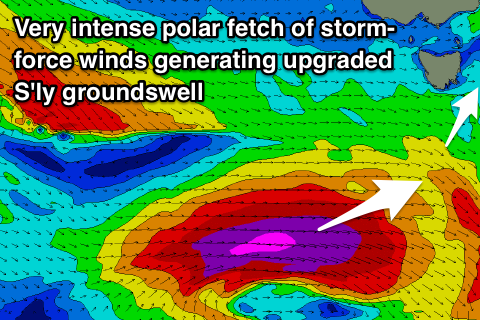
 We've got an upgrade in the S'ly swell due late week and an earlier arrival time, with an intense polar low currently forming south of WA.
We'll see this low project a fetch of severe-gale to storm-force W'ly winds through our western swell window over the coming 24 hours, with a long-period S'ly groundswell due to wrap up and into us Friday afternoon.
We should see south swell magnets reaching 3ft on dark and winds look great with a W/NW tending possibly N'ly breeze, favouring these breaks.
The swell will peak overnight and ease back from 2ft+ Saturday morning with a W/NW breeze. Friday afternoon is definitely the pick of this south swell.
From Monday we should see a couple of further S'ly pulses, but the first for Sunday will be very west in nature and not offer any size across our region. These pulses will be influenced by a strengthening node of the Long Wave Trough to our east, and across the Southern Tasman Sea/New Zealand.
 On the backside of the zonal front generating Sunday's swell, we'll see winds tend more SW while sliding up past us, with chances of 2-3ft sets Monday morning.
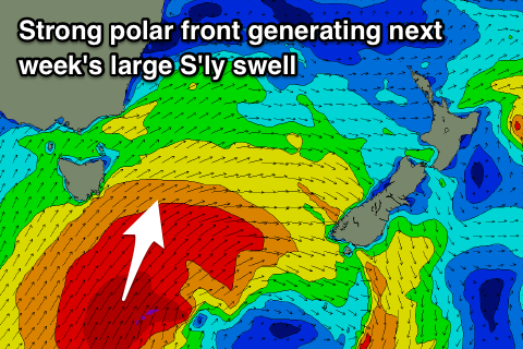
Of much greater importance is a larger S'ly groundswell due Wednesday and Thursday, produced as the best aligned and strongest of the polar storms develops south of us.
We're due to see an initial fetch of SW gales produce an active sea state for a much stronger fetch of severe-gale S/SW winds to project up and over.
The slow moving nature of this front will generate a large S'ly groundswell for the middle of next week though winds look a little suss Wednesday, better as it eases Thursday. More on this Friday though.

