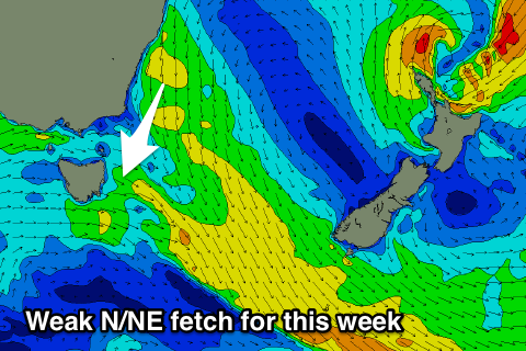
Flukey NNE swell, with better south activity developing
Eastern Tasmania Surf Forecast by Craig Brokensha (issued Monday 17th September)
Best Days: Desperate surfers Wednesday morning north-east swell magnets, south swell magnets Saturday morning
Recap
A small pulse of fun N/NE windswell on Saturday, followed up by a smaller building S'ly swell yesterday, fading back into this morning.
Today’s Forecaster Notes are brought to you by Rip Curl
This week and weekend (Sep 18 – 23)
 Unfortunately this coming week remains void of any major surf with the only possibly increase in swell due Wednesday.
Poorly aligned N/NW winds tomorrow will hardly generate anything above 1ft, while a burst of better aligned N/NE winds down the southern NSW coast into the evening may produce a small 1-2ft wave Wednesday at swell magnets with a morning offshore.
Of greater importance is a strong node of the Long Wave Trough developing across the Tasman Sea on the weekend, stalling into next week.
This will direct a series of strong polar fronts more and more favourably through our southern swell windows, the first being zonal but strong, with a fetch of severe-gale to storm-force W'ly winds produced south-west of the state.
This should produce a good S'ly groundswell for late Friday to 2ft at south magnets, easing from 2ft to maybe 3ft early Saturday.
We'll then see some downtime before a series of vigorous fronts start pushing up past the south-east corner of the state, the best likely to generate a moderate to large S'ly groundswell for the middle of next week. More on this Wednesday though.

