Make the most of the fading swell
Eastern Tasmania Surf Forecast by Craig Brokensha (issued Friday 7th September)
Best Days: Saturday morning
Recap
Well, after the models upgraded the north-east fetch and in-feed on Wednesday, in the end they backed it off again through yesterday, and as a result we didn't see the swell reach the size that was expected yesterday and this morning.
Still there's fun easing sets from 3ft across the coast, worth making the most of as the rest of the period is near flat.
Today’s Forecaster Notes are brought to you by Rip Curl
This weekend and next week (Sep 8 - 14)
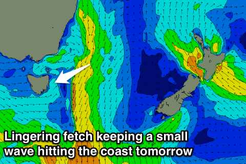
Today's N/NE windswell will fade this afternoon and further overnight with the fetch of NE winds in our swell window, moving slowly away to the east.
This should provide a 1-2ft wave at north-east swell magnets early, flat into the afternoon with a freshening W/NW breeze.
 Unfortunately from Sunday we'll see a zonal pattern setup across the state resulting in no significant swell producing systems within our swell window.
A tiny and weak N'ly windswell is likely to develop Tuesday but the fetch generating this will be fairly weak and short-lived.
By the time winds go offshore, we'll be looking at fading 1ft sets Wednesday.
Longer term there's nothing of significance showing, but let's hope this isn't an early start to spring.
Check back here Monday for any hope, and in the meantime, have a great weekend!

