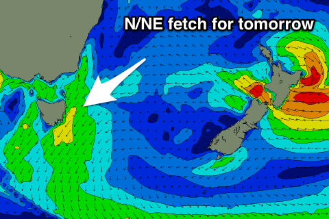
Mix of building E and N/NE swells tomorrow, small and fading Wednesday
Eastern Tasmania Surf Forecast by Craig Brokensha (issued Monday 11th Jun)
Best Days: Late Tuesday in northern corners, early Wednesday
Recap
Tiny surf through the weekend and today with nothing really of note.
Today’s Forecaster Notes are brought to you by Rip Curl
This week and weekend (Jun 12 - 17)
Want to receive an email when these Forecaster Notes are updated? Then log in here and update your preferences.
Our fun pulse of E'ly swell for tomorrow is still on track, with a weak Tasman Low generating a weak fetch of E'ly winds through our swell window yesterday and this morning.
The swell should build through the day and reach 3ft across open beaches, mixed in with some local N/NE windswell to a similar size.
 This windswell will be produced by strengthening N/NE winds in our swell window this evening and tomorrow, with 3ft sets due across north facing beaches, though with poor N/NE winds.
We may see winds tend NW on dark, but Wednesday is the best chance to see offshore winds with a trough pushing east swinging winds W/NW.
We'll see a mix of easing N/NE and E swells from 2ft+.
From here the surf will become flat ahead of some possible new large S'ly swell on Sunday as a deepening mid-latitude low drifting from the south-east merges with a polar front and we see a fetch of S'ly gales projected straight up past our coast.
Any swell will be with south wind, cleaner and easing Monday, but more on this Wednesday.

