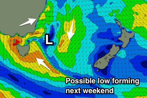
Slow outlook continues
Eastern Tasmania Surf Forecast by Craig Brokensha (issued Friday 27th April)
Best Days: No good days
Recap
A fun kick in swell yesterday, likely from the low sitting off the NSW coast, coming out of the NE and providing 2-3ft sets, fading back today.
Today’s Forecaster Notes are brought to you by Rip Curl
This weekend and next week (Apr 28 – May 4)
Small and inconsistent levels of NE swell should persist tomorrow to 1ft to occasionally 2ft across north-east magnets, produced by a weak but persistent fetch of NE winds in the Tasman Sea.
 The swell is due to fade through Sunday while a weak S'ly change may kick up a poor 1-2ft of S'ly windswell through the day.
Unfortunately the possible fetch of SE winds exiting New Zealand's Cook Strait isn't due to form, with a low developing more west, and out of our swell window.
The models are still picking up a signal of E'ly swell on Tuesday but I wouldn't expect anything above 1-2ft.
There's nothing significant on the cards until next weekend where the models are starting to firm on the development of a low right off our coast. If this happens we'll see large stormy S/SE swell developing but we'll have another look at this Monday. Have a great weekend.

