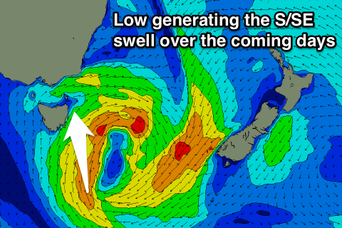
Fun S/SE swell over the coming days
Eastern Tasmania Surf Forecast by Craig Brokensha (issued Monday 20th February)
Best Days: Tuesday, Wednesday morning, early Thursday at north magnets
Recap
A fun small S/SE groundswell the last couple of days on the coast with offshore winds each morning.
Today we're back to tiny surf.
This week and weekend (Feb 21 - 26)
Currently a low is developing south-southeast of us and with this we're seeing a fetch of strengthening S/SE winds through our southern swell window.
This will produce a good S/SE swell for tomorrow and Wednesday morning, coming in around 3ft at south facing beaches, easing from 2-3ft early Wednesday.
 Winds are looking decent with a W/SW tending NE breeze tomorrow and then N/NW tending NE winds on Wednesday.
Wednesday evening the NE fetch will intensify, generating a building NE windswell overnight. The swell will ease rapidly from 2ft or so early Thursday as a front moves through around dawn.
North facing beaches should offer 2ft sets early with a W'ly offshore ahead of sea breezes.
Longer term, a cold front pushing up past us on Saturday will generate a small weak S'ly windswell with onshore winds into the afternoon, cleaner but fading Sunday.
Beyond this there's nothing major still on the cards besides a small NE windswell event early to mid-next week. More on this Wednesday though.

