Good S'ly energy with strong offshore winds to end the week
Eastern Tasmania Surf Forecast by Guy Dixon (issued Wednesday 13th July)
Best Days: Thursday and Friday.
Recap:
The past few days have been pretty poor with dribbles of easterly energy no bigger than 1ft accompanied by strong northerly tending west/southwesterly winds.
This week (Thursday 14th - Friday 15th):
Following the low point in swell we’ve seen in the past few days, we are due to see a mix of building southerly and easterly energy.
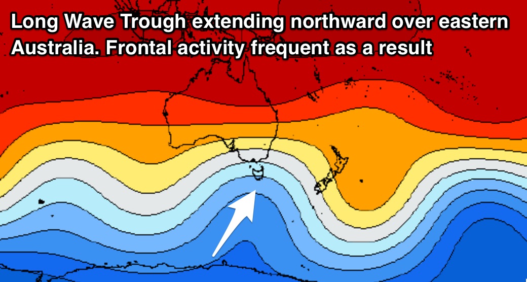
 First off, frontal activity looks to increase over eastern Australia primary due to a strong node of the Long Wave Trough shifting over the region.
Overnight, we saw pre-frontal northwesterly fetches tend southwesterly, providing building energy throughout today and coming days.
South facing beaches should see sets build throughout this afternoon and evening, with sets in the 3-5ft range on Thursday morning. This initial energy will largely be short-mid range energy, with more substantial periods building during the afternoon, maintaining options in the 3-4ft range.
Further intensifications of slingshotting southwesterly fetches up to 50kts should provide another pulse on Friday morning to around 3-5ft, easing throughout the day as frontal activity dies down.
Meanwhile, easterly energy which has been traversing the northern Tasman Sea over the past few days generated by the eastern most fetches of last week’s low as it moved east of New Zealand. This swell should provide inconsistent, less significant sets in the 2ft range at open beaches on Thursday and Friday - a good source of energy for those spots that will miss out on the southerly swell.
Quality won’t be an issue on Thursday and Friday with strong westerly breezes easing slightly and tending west/southwesterly.
This weekend (Saturday 16th - Sunday 17th):
Residual energy will be the main source of energy for the weekend, with Saturday easing from around 2ft, becoming small on Sunday.
Easterly energy will also fade from an inconsistent 1-2ft on Saturday morning, becoming negligible thereafter.
Conditions should remain clean with west/northwesterly breezes on Saturday tending northwesterly on Sunday.
Next week (Monday 18th onward):
Each swell window looks to remain fairly quiet/unfavourable until later on Monday into Tuesday when strong southwesterly trailing fetches intensify following a front. At this stage, it looks like we are due to see the swell build into the afternoon on Tuesday before easing on Wednesday.
More detail on this system as the situation develops.

