Slow week until Thursday, more action next week
Eastern Tasmania Surf Forecast by Craig Brokensha (issued Monday 13th June)
Best Days: Thursday afternoon south swell magnets, Sunday south swell magnets
Recap
No real size left out of the east over the weekend with tiny 1-1.5ft waves all weekend. A new S'ly pulse showed across south swell magnets but has faded into today.
This week and weekend (Jun 14 - 19)
There's nothing significant due over the coming days besides an inconsistent long-range E/NE groundswell to 1-2ft across open beaches tomorrow, fading Wednesday. This was generated north of New Zealand and will be very very inconsistent. Offshore winds will keep conditions clean all day.
Our next increase in meaningful swell is due Thursday afternoon. This will be a long-period S'ly groundswell refracting up from the Southern Ocean.
An intense polar low is expected to generate a fetch of severe-gale pre-frontal W/NW winds, followed by storm-force W'ly winds.
A strong groundswell will be generated for the South Arm, but our south swell magnets should see inconsistent sets to 3-4ft under a fresh offshore NW'ly.
The swell will ease back rapidly overnight, with fading 2ft sets Friday under an early NW'ly ahead of a S'ly change.
 Into the weekend some smaller S'ly groundswell from a less favourably aligned and weaker polar front is due, with 2ft+ sets due across south facing beaches Sunday.
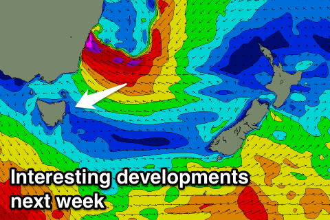
Of greater importance are the developments into early next week, with an inland surface trough due to merge with a deepening trough along the Eastern seaboard, helped by higher than normal sea surface temperatures off the southern NSW coast. This may all culminate in the development of an East Coast Low or similar system, generating large E/NE groundswell for us mid-next week. We'll have a closer look at this Wednesday though.

