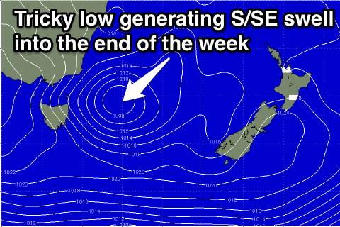
Options later in the week
Eastern Tasmania Forecast by Craig Brokensha (issued Friday 20th March)
Best Days: Later in the week
Recap
Tiny waves Saturday and then an increase in NE windswell Sunday with morning offshores creating clean fun conditions.
Today the NE windswell was holding a similar size to 2-3ft with the fetch of NE winds aimed into us not quite reaching the intensity forecast on Friday. Winds have swung offshore as well followed by a S'ly change, favouring southern corners which are picking up the most size
 This week and weekend (Mar 24 - 29)
This afternoon's S'ly change should kick up a pulse of S'ly windswell tomorrow to a weak 2ft+ across south facing beaches but conditions will be average and not worth chasing with W/SW tending SE and then E/NE breezes.
Into the end of the week there's nothing too major until an intense mid-latitude low stalling off our West Coast Thursday pushes east and across us Friday.
This should see a fetch of strong E/SE tending SE winds aimed into us, kicking up a moderate sized S/SE swell.
The size and timing is moving around a bit with the models diverging on the intensity and position of the low as well as its timing moving across us. The latest available data has it moving through Thursday morning now, kicking up 3-4ft of S/SE swell for Friday, easing Saturday, so we'll have to have a much closer look at this system on Wednesday.
Winds are generally looking to be from the south-western quadrant, but more on this Wednesday.

