/reports/forecaster-notes/western-australia/2025/06/13/plenty-activity-and-better-conditions-metro
Lorena Woortmann
Friday, 13 June 2025
A few good days up north with one window at the South West early week.
/reports/forecaster-notes/western-australia/2025/06/11/best-today-tricky-otherwise
Craig
Wednesday, 11 June 2025
The coming period is tricky wind wise with the constant progression of frontal systems. Today in metro regions looks like capitalising on.
/reports/forecaster-notes/western-australia/2025/06/09/plenty-windows-the-metro-regions-week
Lorena Woortmann
Monday, 9 June 2025
A few incoming WSW pulses with clean days up north, but mostly blown out down south.
/reports/forecaster-notes/western-australia/2025/06/06/fun-weekend-ahead-large-tricky-week
Lorena Woortmann
Friday, 6 June 2025
Have fun over the next few days off pumping surf as there is a lot of uncertainty into next week
/reports/forecaster-notes/western-australia/2025/06/04/fun-days-ahead
Lorena Woortmann
Wednesday, 4 June 2025
Improved forecast for the weekend and possible pumping days next week
/reports/forecaster-notes/western-australia/2025/06/02/large-surf-tricky-winds-early-week-better
Lorena Woortmann
Monday, 2 June 2025
Tricky conditions through the week with some limited options at certain regions, but we have a good weekend ahead with one pumping day across the whole coast.
/reports/forecaster-notes/western-australia/2025/05/30/one-day-target-period
Craig
Friday, 30 May 2025
Clean conditions will be hard to come by this period, with one day standing out from all others.
/reports/forecaster-notes/western-australia/2025/05/28/tricky-outlook-solid-west-swells
Craig
Wednesday, 28 May 2025
The coming outlook contains lots of north wind and tricky west swells.
/reports/forecaster-notes/western-australia/2025/05/26/make-the-most-today
Craig
Monday, 26 May 2025
Today is the pick of the period surf wise across all locations.
/reports/forecaster-notes/western-australia/2025/05/23/metro-locations-tomorrow-the-south-west-monday
Craig
Friday, 23 May 2025
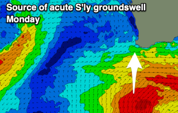
The surf isn't expected to improve until Monday in the South West, but with a large, acute S'ly groundswell.

