Sydney, Hunter and Illawarra Surf Forecast (issued Friday 14th March)


Ben , will swell the swell size be noticeably smaller around the Ulladulla/bawley area over Sunday/Monday ?


I'm gonna ask this question too,
Would it to be bigger as I might do a FIFOMIFO WITH A MATE....?


Wellymon thats my trademark. gunna head south, hope it is an even spread.


I know M3, was trying to get some feed back Mick
I'm booked mick-free, looking forward to getting down back to place I know well with some good friends, away from this shit fight up here.
Cheers Ben . much appreciated......


Good luck wellymon. Just drove past Werri beach and its 2 foot so nothing yet. Everyone's frothing around the beaches though


Thanks Mick
You're the one who has driven me.
FIFOMOFO
Hey I'm not chasing the swell or big like yourself
I just want to Getz out of this over crowded place and back to nature


She'll be a good swell. I don't think it will be that big but solid double overhead. The water temp has dropped a heap too. Freezing cold NE ground swell. Hit me up on mpfreemo@hotmail.com if you are around. I'm south of Ulladulla.


Just got in from a surf on the Coal Coast. Was choc-full at most places but I found a little nook and scored a solo session. About 2 to sometimes 3 foot with no discernible sign of an increase, yet I've just looked at the Byron Bay directional spectra and it's a clearly hit there.


Not much on the northern beaches through to dark. A few 2ft sets maybe 3 at the absolute magnets but kind of weak anyway. Interesting day tomorrow for sure.


Just filled the car up with boards - 5'11" through to 7'2" (you never know!). Screwed fins in and waxed a few bare patches. Tossed wetties in the car, sunscreen, and a few bananas. Mates have been calling and there's been a lotta talk about tomorrow. Plan is for a 6am meet at a nearby left reef. Consensus is that as the wind swings SW through the morning and tide rises another right reef should begin to fire.
Fuck I love going through this process...


Go get em stu . Goodluck there


At 6 am lucky to be solid 3 hope she grows up during the day. At Narrabeen wind should get the bump out of it by mid morning.
Update...Outside Marques is SOLID 5+ now and marching in.


caml wrote:Go get em stu . Goodluck there
Cheers Camel, 'twas a very solid day of surfing down this way. Not huge, though there was the odd 8ft set about, but very long-lined swell sweeeping in under an all day offshore - a fucken great combination.
The crowds piled up from mid-morning to mid-arvo, but the first hour at the local left reef and last hour at local sand over reef beachie were as good as surfing gets on this coast.
Knackered...


Pretty damn good in Sydney too Stu. The biggest sets were rare and randomly spaced but solid and consistent in good conditions all day.


I imagine the love would have been spread far and wide today. Cyclone swells, eh? We're very dubious of the swell creating potential of cyclones here at Swellnet. They're often heavily over-hyped, and the reality is that very few cyclones actually create good swell.
But man, when they provide they're very special indeed. And when they're far enough offshore (as Lusi was) the whole coast lights up! I'm hearing stories from up and down the East Coast about this swell; they create a real connection, a feeling of shared experience despite great distances.
The East Coast's bread and butter is short range, short lived windswell that mostly acts on small pockets of coast. Days like today are an all too rare treat.
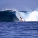

It was pretty special at a certain Northern Beaches break today, especially on dusk.... lets hope the morning continues to deliver the goods?
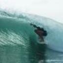

stunet wrote:Just filled the car up with boards - 5'11" through to 7'2" (you never know!). Screwed fins in and waxed a few bare patches. Tossed wetties in the car, sunscreen, and a few bananas. Mates have been calling and there's been a lotta talk about tomorrow. Plan is for a 6am meet at a nearby left reef. Consensus is that as the wind swings SW through the morning and tide rises another right reef should begin to fire.
YEW!!
Hope everyone scored cause I know I did :3 :3


unfortunately I was working yesterday so had to duck out there before work, which meant to go to Cronulla point I may have caught 1 wave with the crowd, got stuck on the close out beachies, so frustrating to have such good lines but the wrong banks


Phewww
What a funky journey
That was fun


Sydney, Hunter and Illawarra Surf Forecast by Ben Matson (issued Friday 14th March)
Best Days: Sunday/Monday: Solid E/NE swell with offshore winds. Tuesday/Wednesday: smaller surf but with generally OK conditions.
Recap: Small swells from the south and E/NE. A slow increase starting to occur from the week’s trade wind activity in the northern Tasman Sea.
This weekend (Mar 15-16)
No changes to the weekend forecast from Wednesday's notes. We'll see slowly building trade swell throughout Saturday, but generally hampered by freshening northerly winds - so keep your expectations low.
From sometime late Saturday afternoon onwards we’re likely to see the leading edge of cyclone swell from TC Lusi make landfall - most of this swell will fill in on Sunday but I reckon there’s still a good chance for a very late, significant kick in size on dark across the Hunter, Sydney and Wollongong region on Saturday (but much less of a chance on the South Coast).
Winds will veer NW on Sunday morning as a weak pre-frontal trough pushes across the coast, before winds swing to the SW in the afternoon. This will quickly clean up conditions across most regions however there’s certainly a chance for a few leftover bumps in the early morning. As for wave heights, we’re looking at really strong 5-6ft surf across most open stretches throughout the day, peaking into the afternoon. Due to the distance source of the swell, it’ll be a little inconsistent at times but on the whole we’re looking at a great day of waves in central and southern NSW.
Next week (Mar 17-21)
Monday will also see excellent waves right across the region, however we will be on the downwards phase of this swell. We'll see some solid sets in the morning (anywhere between 4ft and maybe 6ft at exposed beaches) but it'll trend steadily downwards during the day, probably into the 3ft range, and it’ll become less consistent too. Wind wise we’re looking at light variable winds - probably an early W’ly breeze tending onshore into the afternoon.
From here on we’ll see very slowly easing swells from the east, along with some small refracted S’ly energy at times thanks to a series of fronts passing south of the Tasman Sea (poorly aligned within our swell window due to a strong zonal flow).
This downwards trend looks like it’ll bottom out Thursday ahead of a small increase in trade swell on Friday, originating from some exciting developments NE of New Zealand early next week. It won’t have a lot of size across the southern NSW coast but should still be enough to kick up energy at exposed beaches. I’ll detail this more comprehensively on Monday.
Long term (Mar 22 onwards)
It looks like the Tropical South Pacific will fire up yet again later this weekend and into early next week with a strong, stationary E'ly fetch way out east of the dateline (and likely to merge with yet another Tropical Cyclone well east of Fiji).
Despite the enormous distance from the mainland, we’ll see both an increase in small E/NE swell from Friday through next weekend, ahead of a larger long period swell filling in later Sunday and into Monday that could provide some solid, if very inconsistent waves to the region.
This bigger pulse is expected to be the result of a slowly retrograding fetch of storm-force winds, contained within a broad easterly belt of trade wind stretching all the way to the Queensland coast. Such a synoptic setup is quite rare and there’s a chance that the models could very well upgrade several characteristics of this setup, leading to an ever better forecast for the timeframe around next Sunday/Monday/Tuesday. Stay tuned to next week’s updated forecasts for more details.