Easing surf with onshore winds, better later week
Western Australian Forecast by Craig Brokensha (issued Monday December 2nd)
Best Days: Thursday morning, Friday morning, Saturday morning in the South West
Features of the Forecast (tl;dr)
- Easing surf tomorrow with strong NW winds (lighter dawn Perth/Mandurah)
- Smaller Wed with fresh W/NW tending SW winds
- Moderate sized swell Thu with S/SE-SE tending strong S/SW winds in the South West, S/SE to the north in the AM
- Moderate + sized mix of W/SW and SW swells Fri with E/SE-SE tending strong S/SW winds
- Easing surf Fri Sat with gusty E/SE-SE winds
- Smaller Sun with S/SE winds
- Mod-large sized groundswell likely early next week with S/SE winds
Recap
The weekend was generally poor with only a small window of clean conditions with a small swell in the South West Saturday morning, onshore and then building in size from yesterday but mostly today.
This week and weekend (Dec 3 - 8)
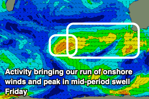
Today’s large swell and the run of onshore winds is thanks to a strong, slow moving low pushing up and across us while weakening. This has brought a large increase in swell but with strong onshore winds.
Unfortunately behind the low is a series of persistent, weaker mid-latitude fronts and these will keep winds onshore for the coming days, backing off Thursday.
Strong NW winds are due tomorrow (lighter dawn Perth/Mandurah) with a drop in size from today across all locations, with fresh W/NW tending SW winds on Wednesday.

Come Thursday we should see winds swing back to the E/SE-SE across the South West, S/SE to the north but with smaller, weaker levels of mid-period energy. Surf to 4-6ft is due in the South West, 2ft+ Mandurah and 2ft Perth, while come Friday a new pulse of mid-period energy is due.
This will be generated off the backside of the mid-latitude frontal systems moving in over the coming days, with a little kick in energy to 5-6ft across the South West, with Mandurah holding 2ft+ and 2ft across Perth.
Winds should improve further and swing E/SE across all locations ahead of strong sea breezes, with easing surf under a gusty E/SE-SE offshore wind on Saturday.
Come Sunday, smaller surf and a S/SE breeze will leave no real options for a surf.
The surf will bottom out early Monday, but this only looks temporary, with a healthy frontal system due to fire up, south-west of us through Friday and into Saturday.
This looks to generate a moderate to large sized groundswell for Monday afternoon/Tuesday along with S/SE winds. More on this Wednesday.

