Large wintry swell enroute for Monday
Western Australian Forecast by Ben Matson (issued Friday November 29th)
Features of the Forecast (tl;dr)
- OK waves in Margs on Sat, initially small but building during the day
- Poor everywhere Sunday with onshore winds
- Very large windy surf Mon/Tues
- Large but slowly improving surf Wed with light/mod SW winds; fun waves on metro beaches
- Extended spell of small windy waves coming up Thurs onwards
Recap
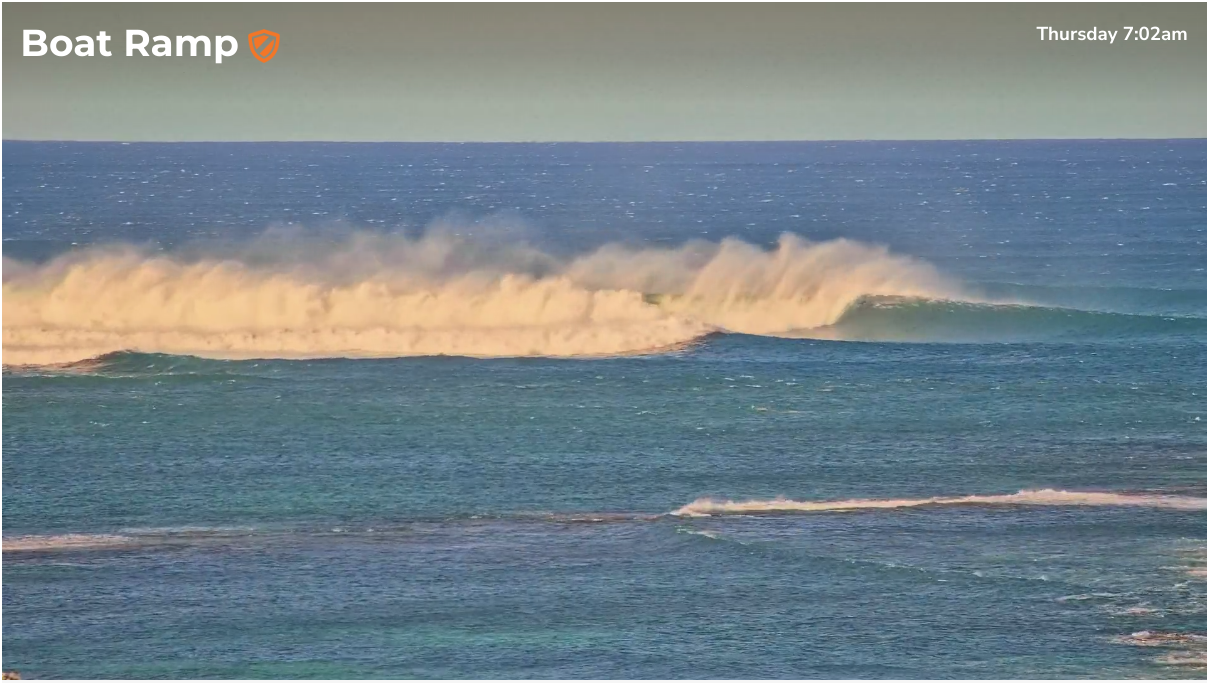
Margaret River saw large surf on Thursday in the 8-10ft range, with gusty offshore winds making for clean though blustery conditions. Metro beaches underperformed with slow 1-2ft sets across Perth beaches, reaching 2-3ft in Mandurah, with lighter offshore winds and afternoon sea breezes. Wave heights have eased back rapidly in the Margs region overnight, now down to a slow 3-4ft though still clean with offshore winds. Metro beaches are very small but equally clean.

Large, blustery and challenging Thursday morning in the Margs region
This weekend (Nov 30 - Dec 1)
Onshore winds will develop across the coast on Sunday as a cold front clips the southern part of the state. As such Saturday is your best day for waves with early light offshore winds tending northerly then southwesterly into the afternoon as a weak pre-frontal trough moves east across the region.
Surf size will be initially small (down a touch from today) but a decent rise is expected through the morning from another distant combo fetch associated with a polar low traversing the Southern Indian Ocean earlier this week.
Early surf will probably be in the 3ft range across the Margs region (very inconsistent too) but by mid-late afternoon we should see 5-6ft sets at exposed spots. The main risk at this time will be the chance for an onshore wind, so be prepared to pounce as soon as you see any sign of the new energy.
Saturday is not a high confidence day for quality waves so don't be overly fussed if you can't make the most of it.
Metro beaches won't see much of an increase from this swell, expect very small conditions early Saturday morning and maybe some stray 1-2ft waves mid late afternoon, with a similar onshore wind risk as down south. Sunday will be onshore with small waves persisting.
Next week (Dec 2 onwards)
I like the look of the weekend low generating Monday’s large swell. It’s expected to stall in its eastward track and then slingshot up through the swell window, allowing for a capture fetch that should generate 10-12ft+ surf at exposed Margs breaks - but moderate to fresh onshore winds will create poor conditions.
Additionally, a series of secondary fronts rearing up from the west will steer the onshore flow from the west to the west/northwest which will significantly reduce the chance for rideable options inside sheltered bays and points. So keep your expectations low… this looks to be somewhat of a disappointing swell event to begin with.
These secondary fronts will however generate additional large W’ly tending SW swells from Tuesday thru’ Wednesday - maintaining size somewhere in the 8-10ft range at exposed spots. Tuesday looks to be a write-off with NW winds but we'll see moderate SW winds in the lee of the fronts on Wednesday allow for smaller clean waves across protected bays and points.
Similar winds are expected across the Perth region though with a little less strength, and the surf profile will mirror Margs’ trend - up steadily Monday (3-4ft most beaches) before easing slowly through Tuesday. Wednesday should manage fun lumpy leftovers in the 2-3ft range.
Long term is still suggesting an extended run of summereque small surf with fresh S/SE winds as a high pressure ridge remains slow moving to our west.
As such make the most of the nativity over the next few days as there is nothing significant on the horizon.
Have a great weekend - see you Monday!

