Poor run of winds and large swell kick in again
Western Australian Forecast by Craig Brokensha (issued Friday August 23rd)
Best Days: Wednesday Perth and Mandurah, early Thursday Perth and Mandurah, next weekend
Features of the Forecast (tl;dr)
- Strong to near-gale-force W-W/SW winds Sat with an oversized, building stormy swell, peaking late, easing Sun
- Strong W/NW wind Sun
- Large W/SW groundswell Mon with strong NW winds
- New, large mid-period W/SW-SW swell building Tue, peaking Wed with strong W/NW tending W/SW winds Tue
- Moderate W tending NW winds Wed, E/NE-NE early Perth and Mandurah
- Easing surf Thu with strong N/NE tending NW winds
- Large swell late week with strong W winds, likely tending S/SE next weekend
Recap
Yesterday morning finally offered some great waves in the South West with gusty offshore winds and clean conditions as Wednesday afternoon’s inconsistent W/SW groundswell eased back from the 8ft range, 2-3ft further north.
Today onshore winds and a localised W/NW-NW windswell is breaking across metro locations while Margs has seen winds temporarily shift NE creating a window of OK conditions across selected spots. Winds will quickly shift back to the NW though.

Great conditions yesterday morning along with a bit of size
This weekend and next week (Aug 24 - 30)
As touched on in Wednesday’s notes, we’ve got a significant frontal system due across the state on the weekend, but the models have downgraded the strength just a touch, with winds not likely to reach gale-force across the metro regions, more so southern regions and to the east.
What this front will still do is whip up an oversized stormy swell tomorrow, peaking later in the day before easing into Sunday.
Strong to near gale-force W tending W/SW winds are due tomorrow with a peak to 12ft+ due later in the South West, 4-6ft across Mandurah and 3-5ft in Perth, easing Sunday with strong W/NW winds.
Now, come Monday, the large W/SW groundswell generated by the earlier, strongest parts of the low should fill in, peaking to 12ft+ across the South West, 4ft Mandurah and 3ft Perth but with poor, strong NW winds again.

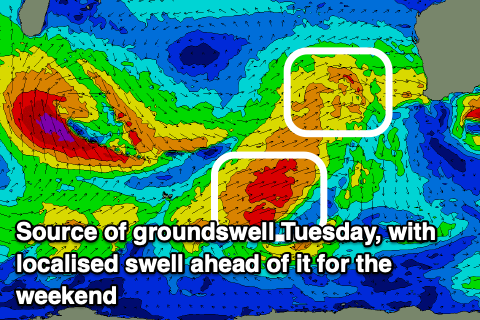
Strong onshore W/NW tending W/SW winds will persist Tuesday as the next surge of frontal activity moves through, though from more polar latitudes.
This will bring some new, large mid-period W/SW-SW swell for Tuesday/Wednesday along with a window of light E/NE winds in Perth and Mandurah on the former.
It’ll be quite lumpy but improving and we should see good sized sets to 2-3ft in Perth, 3ft+ across Mandurah on Wednesday morning, easing through the day.
Into the end of the week, another frontal system will approach the region bringing stronger N/NE tending NW winds and some new mid-period W/SW energy again in the large size range.
The question is, when will all this frontal activity finally back off, and it looks to start happening next weekend but more so into the following week, the first of September. More on this Monday. Have a great weekend!

