Strong swell to end of the week with clean morning conditions
Western Australian Surf Forecast by Craig Brokensha (issued Wednesday October 4th)
Best Days: Today, tomorrow, Friday morning, Saturday and Sunday mornings in the South West
Features of the Forecast (tl;dr)
- Large S/SW groundswell building tomorrow with moderate E/SE-E winds ahead of mid-afternoon sea breezes
- Steadily easing swell Fri with similar winds (E/SE in the AM)
- Smaller surf Sat with E/NE-NE tending S/SW winds
- Moderate sized SW groundswell Sun with fresh E/NE-NE tending N/NE then NW winds
- Small Mon with W/SW winds
Recap
The surf was still bumpy and onshore at dawn across Mandurah and Perth yesterday, though winds quickly eased and tended cross-offshore providing improving surf with solid 4ft sets across the former, 3-4ft across the latter. Margs was maxing and onshore, best in protected spots through the day as winds slowly backed off.
This morning we've got cleaner conditions across the state with easing surf from 6ft to occasionally 8ft on the South West magnets, 3ft Mandurah and 2ft+ Perth. Light sea breezes are due in the South West today, worth making the most of.

Solid sets early with cleaner conditions today
This week and weekend (Oct 5 - 8)

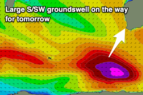
The XL swell energy seen earlier in the week will continue to ease into tomorrow, but a large, new S/SW groundswell is due to take its place, generated by a low that 'bombed' late in our swell window, to the east of the Heard Island region the last two days.
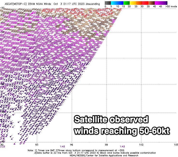
Satellite observations confirm a fetch of storm-force winds being generated in our southern swell window with 50-60kt purple barbs shown left.
This will result in a large, long-period swell that should arrive tomorrow morning and build back to the 8-10ft range on the South West magnets through the day, 2-3ft in Mandurah and 2ft across Perth after lunch.
Winds look great through the morning and offshore from the E/SE-E, tending variable early afternoon ahead of gusty S/SW sea breezes. The swell will ease steadily through Friday, back from 6ft to possibly 8ft in the South West, 2-3ft Mandurah and 2ft Perth along with morning E/SE breezes.
Winds look to again hold until early to mid afternoon ahead of sea breezes.

As the swell eased further into the weekend, moderate E/NE tending NE winds will favour the south magnets in the South West, even more so Sunday with fresher E/NE tending N/NE winds, shifting NW-W/NW into the afternoon as a moderate sized SW groundswell arrives.
The source of this groundswell will be a fetch of gale to severe-gale W/NW winds trailing the low linked to tomorrow's swell. The South West should kick back to 5-6ft with smaller waves to the north coming in at 1-2ft across Mandurah and 1-1.5ft in Perth.
Weak onshore W'ly winds look to trail a trough and change on Sunday evening, with Monday looking poor as the surf eases. Longer term next week looks mostly small and with pesky onshore winds. More on this Friday.

