Windy weekend, better early next week
Western Australia Surf Forecast by Craig Brokensha (issued Friday 2nd October)
Best Days: Protected spots tomorrow, Perth and Mandurah Sunday morning, Monday, Tuesday morning in the South West
Recap
Poor waves across the South West yesterday and today, onshore but workable for the keen further north yesterday, deteriorating into today.
This weekend and next week (Oct 3 - 9)
The recent run of onshore winds should slowly start to improve from the weekend, but it’ll be next week that offers the cleanest conditions.
 A high pressure ridge will try and move in on the weekend but a couple of weak polar fronts projecting towards the Bight will keep it west of us until Monday.
Tomorrow we’ll see winds swing around to the S’th, strong across the South West, easing a touch into the afternoon while tending S/SW. Mandurah and Perth should see moderate to fresh S/SE winds in the morning, onshore into the afternoon.
Looking at the surf and a new S/SW groundswell is due tomorrow morning, produced by a broad and not overly strong but slow moving fetch of SW winds that were south-west of us the past few days.
Margs should see good 6-8ft sets (easing through the day), mixed in with some mid-period energy and these may combine to produce the odd sneaker set. Mandurah looks to hang around 2-3ft, with 2ft waves in Perth.
One of those pesky fronts will push up and clip the state Sunday, bringing S/SW winds to the South West, better and S/SE-SE during the morning around Perth and Mandurah. The swell will be on the ease and dropping from 5-6ft across the South West, 2ft in Mandurah and 1ft to possibly 2ft in Perth.
Monday is the pick for the South West with the high finally edging in, swinging winds around to the E/NE, fresh through the morning before easing and tending variable ahead of late sea breezes.
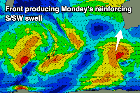
The front on Sunday should provide some new S/SW swell as well. It’ll be mid-period energy but should come in at 4-6ft across the South West magnets, 1-2ft max in Mandurah, tiny in Perth.
 Smaller surf is expected on Tuesday and winds will be fresh out of the NE in the morning, N’ly into the afternoon, leaving the South West with the best waves. Wednesday looks like a lay day as the swell bottoms out and winds go more N’ly and NW into the afternoon with an approaching, weak cold front.
The earlier stages of this front should produce a moderate to large W/SW groundswell, with a healthy fetch of W/SW gales aimed towards us through the weekend. The swell is due Thursday with sets to 6ft to possibly 8ft across the South West, 2-3ft in Mandurah and 2ft in Perth but with onshore SW winds in the wake of the front. Friday may see more onshore winds with another front, but more on this Monday. Have a great weekend!

