Large swell for the weekend, more swells next week
Western Australia Surf Forecast by Craig Brokensha (issued Wednesday 22nd April)
Best Days: Keen surfers Mandurah and Perth tomorrow, Sunday, Monday, Tuesday protectes spots in the South West, Wednesday in the South West, Thursday and Friday
Recap
A new pulse of large swell yesterday but with average conditions across the South West, better further north with 3-4ft sets across Mandurah and 3ft waves in Perth.
Today lighter winds have created much cleaner conditions and better waves across Perth and Mandurah with a drop in swell back to 3ft on the sets, 6ft+ and bumpy though workable in the South West.
This weekend and next week (Apr 25 – May 1)
There's been no real change to our large, long-period SW groundswell due over the weekend, with the remnants of the storm linked to it due to slowly project towards the Bight today and tomorrow, keeping winds onshore across the South West tomorrow. It'll clear by Sunday though creating cleaner conditions.
 So looking at the swell and it's expected to build rapidly tomorrow and peak later in the afternoon to 10ft+ across the South West, 3ft+ in Mandurah and 2-3ft in Perth.
Onshore SW winds will unfortunately create poor conditions across the South West tomorrow, and it looks like Perth and Mandurah won't escape these either, though lighter in strength and more user friendly.
Sunday should become cleaner across all breaks as winds shift to the E/SE through the morning along with easing sets from 8-10ft in the South West, 3ft in Mandurah and 2-3ft across Perth. This easing trend will be slowed by that front bringing tomorrow's onshore winds.
Monday looks great as well as the swell continues to ease with morning E/SE offshores across the South West, more S/SE further north.
A new pulse of S/SW groundswell is due across the South West on Tuesday as a strengthening and small mid-latitude front forms directly south-west of us Sunday evening. A fetch of gale to severe-gale W/SW winds will be generated before the low moves too far east, with the swell peaking Tuesday to 6ft to occasionally 8ft in the South West, only 2ft in Mandurah and 1-2ft in Perth.
 Winds look average unfortunately in the wake of the front clipping the state, bringing strong S-S/SE winds to the South West, better across Perth and Mandurah and S/SE. Wednesday will be much better as the swell eases and winds shift E/NE through the morning.
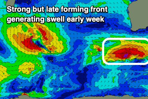
Now, as talked about in the end of the last update, a strong storm is forecast to fire up to our south-west early next week, with a fetch of storm-force W/SW winds blowing for nearly 24 hours.
This should generate a large, long-period SW groundswell for later next week under E/NE-N winds. More on this Monday. Have a great weekend!


Comments
How's the lines in Margs this morning!

Very impresive. The North West has some good energy at the moment too.
Yalls looking really nice today.


How's the roll-in entry on this one!

Thumbs up to the Margs sea rescue crew, it's a long run down to Contos on a ski in those conditions.
https://www.abc.net.au/news/2020-04-25/one-dead-after-two-fishermen-wash...