Large W/SW groundswell to end the week but with troublesome winds
Western Australia Surf Forecast by Craig Brokensha (issued Wednesday 19th June)
Best Days: Margs and Mandurah tomorrow, selected locations Friday
Recap
Large clean and easing surf across all locations yesterday from a pumping 10-12ft in the South West, 3-4ft in Mandurah and 3ft+ in Perth.
Today was great again with easing 6-8ft waves in the South West, 2-3ft around Mandurah and 2ft in Perth.
Today’s Forecaster Notes are brought to you by Rip Curl
This week and weekend (Jun 20 - 23)
As discussed in this forum thread here, the wave model data is incorrect for the coming few days owing to an update we did over the weekend. With the model starting from scratch, the swell due Friday which was generated mostly before the restart is not showing on the charts.
The surf will continue to drop into tomorrow morning but be clean and great across the South West with an E/NE offshore, only tending NE into the afternoon. Margs should still be around 4-5ft, with 2ft sets in Mandurah, 1-1.5ft around Perth.
 Our new large and inconsistent long-period W/SW groundswell for Friday is looking nice, but local winds will be poor as a small low forming to our west moves in. This will bring NE tending N and then N/NW winds as the swell reaches 10-12ft across the South West, if not for the odd bigger clean up, 3-4ft in Mandurah and 3ft in Perth. Remember there'll be long waits between sets, and you'll have to deal with those northerly winds.
Saturday will become poor as the groundswell eases along with strong N/NE tending W/NW winds later in the day.
This will be the start of a large and stormy run of windy swell, becoming XXL into the middle of the week.
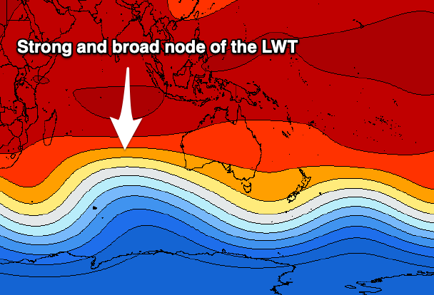
 The forecast for the node of the Long Wave Trough to our west has been strengthened and we'll see back to back polar fronts projected up through our western swell window and then across us from Sunday, but the most significant storm of all will generate a very expansive and slow moving fetch of severe-gale to storm-force W/SW winds between us and Heard Island.
This will generate likely the largest swell of the year for the middle of next week but with winds from the north-west and with strength. Nowhere looks to really escape the wind, but more on this Friday.


Comments
Checking the buoy this morning I was worried about the large new swell due today, but then this showed on the cam..
Falling out of the sky!