Onshore messy surf here to stay
Western Australia Surf Forecast by Craig Brokensha (issued Wednesday 19th July)
Best Days: No good days at all
Recap
Poor conditions across the South West yesterday with a fresh N/NE'ly up at dawn and less than half the size of Monday, but Perth and Mandurah saw good clean 2ft waves through the morning before becoming wind affected into the afternoon.
Today onshore winds are blowing across all coasts with a mix of building swells that'll become large into this afternoon.
This week and weekend (Jul 18 – 23)
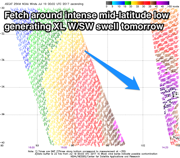
Today we're seeing a large long-range W/SW groundswell building across the state, as well as a closer-range raw W/SW swell from an intense mid-latitude low sitting to our west-southwest.
 This low has generated a fetch of severe-gale to storm-force W/SW winds aimed through our western swell window, and is slowly weakening while moving east today.
With this we'll see a stormy XL W/SW groundswell arriving very late today, peaking overnight and easing through tomorrow.
Margs will be a complete mess with strong W'ly winds and easing 15ft+ sets, while Perth and Mandurah will be big and messy, easing from the 4-5ft range.
Friday won't see any letup in the stormy conditions as another mid-latitude front pushes into the south-west of the state, bringing fresh to strong W-W/NW winds.
This will leave no quality surfing options while also continuing to generate large amounts of W/SW swell, peaking Saturday to 6-8ft in the South West and 2-3ft in Perth.
Our possible period of variable winds Saturday morning isn't looking to promising, and instead we'll see fresh but easing W/SW winds.
Into Sunday and Monday, a weak mid-latitude front will continue to generate onshore winds but fail to generate any significant swell.
 Of greater importance is some good but inconsistent W/SW groundswell pulses through next week across the state.
These swells are and will be generated by the same storms firing up under South Africa, producing pumping waves for the J-Bay Open, but when they arrive here, frustrating onshore W/NW winds look to spoil these swells, with a very intense mid-latitude low moving in.
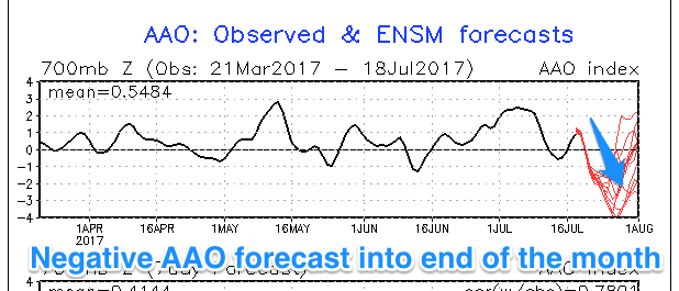
This falls in line with the Southern Annular Mode index (a measure of how far north/south the westerly storm track sits in the Southern Ocean) forecast to be strong negative into the end of the month. This incurs we'll see the storm track positioned more north, but more on this Friday.

