Poor weekend, good Monday and then onshore and large for the rest of the week
Western Australia Surf Forecast by Craig Brokensha (issued Friday 14th July)
Best Days: Monday, early Tuesday
Recap
Large stormy SW groundswell across the South West yesterday morning in the 10ft+ range, while Perth and Mandurah saw poor surf to 3ft.
Today all coasts saw morning offshore E/NE winds will the swell hanging in nicely. Margs offered raw 8ft+ waves for keen surfers, with 3-4ft sets around Mandurah and 2-3ft waves up in Perth.
The swell is on the ease and winds are starting to shift more north with an approaching front.
This weekend and next week (Jul 15 – 21)
The weekend is still looking poor, with today's large SW groundswell expected to ease off further as strong onshore W/NW tending W/SW winds move in across all coasts.
This will be attached to a strong mid-latitude low moving in from the west and we're due to see some building windswell across all locations through the afternoon, though with no quality.
This mid-latitude formed south-east of Madagascar and has generated a fetch of severe-gale to storm-force W/SW winds in our far western swell window (generating a good W/SW groundswell Monday) before tracking east while weakening the last couple of days.
The low isn't expected to stall off our south-west any more, with it moving across us Saturday evening, further off to the east Sunday.
 We'll still see a fetch of strong W/SW-SW winds aimed through our south-western swell window, with a mid-period increase in size due Sunday to 6ft+ across the South West with 2ft+ waves around Perth and Mandurah.
Winds will remain poor with a fresh and gusty but easing SW'ly, while Monday looks great as the long-range W/SW groundswell peaks along with light offshore E'ly winds.
Exposed reefs in the South West should see infrequent 6ft to occasionally 8ft sets most of the day, with 2ft to occasionally 3ft waves in Perth and Mandurah, easing through Tuesday.
You'll have to surf early Tuesday though as a fresh NE'ly at dawn will give into a NW change as another intense mid-latitude low moves in from the west.
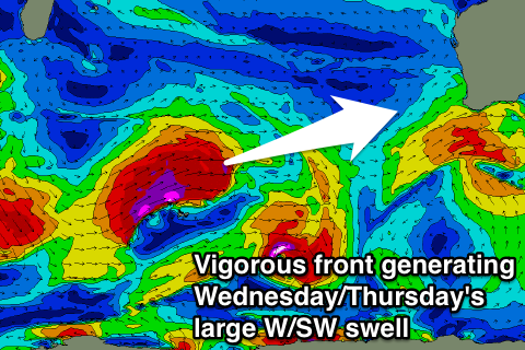
This mid-latitude low will be the final stages of a vigorous cold front moving through the southern Indian Ocean. This front should form south of South Africa today, strengthening and producing a fetch of severe-gale to storm-force W/SW winds in our western swell window all weekend before breaking down Monday.
A large long-period W/SW groundswell should result, arriving Wednesday morning and building to the 10ft range in the South West and 3ft in Perth and Mandurah.
Unfortunately the low will be impacting us at this stage, bringing strengthening W/NW winds, with some large storm surf Thursday along with strong but easing W/SW winds.
Onshore winds are likely to persist into the end of the week, but more on this Monday. Have a great weekend!

