Protected spots for the weekend, good swells next week with generally good winds
Western Australia Surf Forecast by Craig Brokensha (issued Friday 6th November)
Best Days: Protected spots Saturday and Sunday mornings, Monday and Tuesday mornings, Thursday
Recap
Solid clean easing 6ft+ surf across the South West yesterday with light morning winds, and 2-3ft sets around Mandurah, with 2ft+ waves up in Perth. The afternoon was bumpy with onshore winds across all coasts.
This morning a reinforcing swells has come up a little out of nowhere, with similar sized large sets across the South West, and more size around Perth to 2-3ft but with SE winds, favouring more protected spots. This was a welcome surprise for those around for a morning surf, but hard to pin down its origins.
This weekend (Nov 7 - 8)
Fresh to strong S/SE winds will limit options tomorrow across all coasts, with today's swell due to ease back from 4-6ft in the South West and 2ft around Perth.
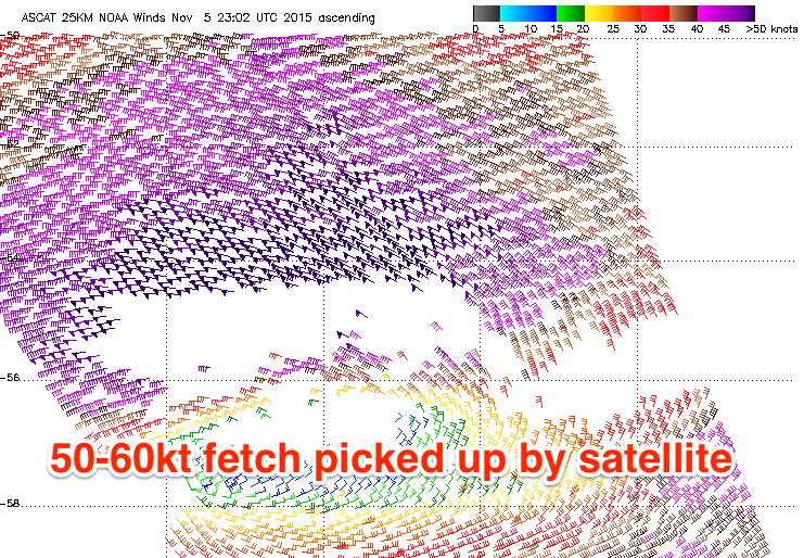
 Sunday's strong kick in SW groundswell is still on track, but the size looks to be a little smaller than forecast on Wednesday. Satellite observations have picked up an impressive fetch of 50-60kt W/NW winds as the low projects less than ideally east-southeast through our swell window.
Without the hurricane strength winds, we're looking at a little less size, with Margs due to pulse through the morning likely peaking at 6-8ft across exposed breaks, with Perth building to 2ft or so.
Winds will remain from the S/SE across Perth, and more S'ly around Margs, although local affects should steer it S/SE through the morning at stages, favouring protected breaks.
Monday onwards (Nov 9 onwards)
While Sunday's swell is due to ease back rapidly through Monday, a good new SW groundswell will take its place, generated by a broad, strong and elongated fetch of strong to gale-force W/SW winds developing on the tail of the 'bombing low'.
A moderate to large SW groundswell should be generated, filling in through Monday and kicking to 6ft to likely 8ft again through the afternoon across exposed breaks in Margs, with 2ft+ sets in Perth through the afternoon. Tuesday should see the swell then easing back slowly from 6ft+ and 2ft respectively across the state.
 Conditions are looking better as well for early next week with an offshore E/SE'ly due Monday morning ahead of S/SW sea breezes and then E/NE tending light to moderate onshore winds Tuesday.
Wednesday morning looks be a low point in activity with dicey and less than ideal S'ly winds. A moderate kick in new SW swell is due into the afternoon, but a larger and more powerful SW swell is expectedThursday.
The source of this groundswell will be a strong polar front being steered up towards us through the weekend and early next week by the Long Wave Trough, projecting a healthy fetch of W/SW gales through our south-western swell window.
A good and consistent swell should be created, with a touch of west in its direction, building strongly Thursday and reaching 6-8ft+ across exposed breaks and 2ft+ in Perth. Winds at this stage look E/SE-SE, but we'll have a closer look at this on Monday. Have a great weekend!

