Fun beachy waves from Wednesday
Victorian Surf Forecast by Craig Brokensha (issued Monday 13th February)
Best Days: Beaches Wednesday, Thursday and Friday until sea breezes develop mid-late arvo, Monday morning
Features of the Forecast (tl;dr)
- Inconsistent, small mid-period W/SW swell building Tue, peaking Wed
- Mod-fresh S/SE winds Tue, light N/NE Wed ahead of mid-PM sea breezes
- Stronger, but inconsistent W/SW groundswell for Thu with mod-fresh N/NE winds ahead of mid-late PM sea breezes
- Slowly easing swell Fri with fresh N/NE-NE winds, possibly holding till late
- Strengthening SW winds Sat (W/NW early Surf Coast) with a low point in swell
- Building mid-period W/SW swell Sat PM, peaking Sun with gusty SW tending S winds
- W/SW swell Mon with N/NE winds ahead of a S/SW change
Recap
Clean conditions on Saturday morning but only surfable on the exposed magnets with a peaky, weak swell easing from 2ft on the sets. A trough brought onshore winds and along with a low point in swell yesterday, still poor today with fresh onshore winds and a small SW windswell.
This week and weekend (Feb 14 - 19)
Looking at the coming period and it's worth targeting mid-late week as winds shift offshore for the beaches along with some fun, inconsistent levels of mid-period W/SW swell.
The first pulse of swell which is due to build tomorrow and hold through Wednesday was generated by a distant, relatively weak polar low which projected north-east up towards Western Australia while weakening late last week.
Any swell from this source will be inconsistent and come in at 2ft on the Surf Coast, 3-4ft to the east.
Winds will remain average tomorrow and moderate out of the S/SE, much better Wednesday as a high moves east, under us allowing winds to swing N/NE through the morning ahead of mid-afternoon sea breezes. This will favour both regions, with the beaches being the pick.
Into Wednesday afternoon we may see some inconsistent W/SW groundswell arriving, though a peak is expected on Thursday. This swell was generated by a much stronger but more distant polar low firing up to the south-east of South Africa, generating a fetch of severe-gale W/SW winds, but east of the Heard Island region.
It'll be very inconsistent but sets to 2ft to occasionally 3ft are due across the Surf Coast, 4-5ft to the east and with moderate to fresh N/NE winds, giving into mid-late afternoon sea breezes again. Patience will be the key for this swell.

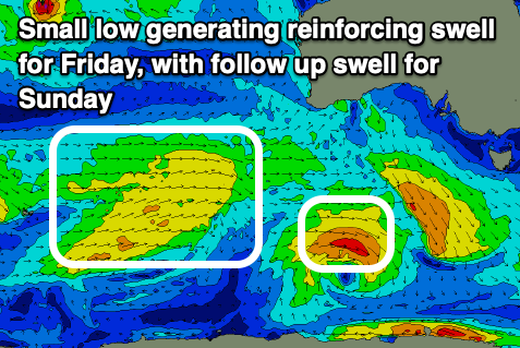
The swell is expected to slowly ease Friday (helped by the arrival of some small, reinforcing mid-period swell generated by off-axis and weak fronts below WA today and tomorrow). A trough will stall just west of us, bringing moderate to fresh N/NE winds that may tend variable into the afternoon ahead of a late SW change.
A temporary low point in swell is due on Saturday morning with early W/NW winds on the Surf Coast, SW elsewhere and strengthening into the afternoon.
Into the afternoon and more so Sunday some inconsistent mid-period W/SW swell should fill in, generated by a broad but weak frontal system projecting east from the Heard Island region over the coming days. This is weaker than forecast last week with inconsistent 2ft+ sets are due on the Surf Coast with 4ft waves to the east Sunday but with gusty SW tending S/SE winds.
Monday looks better and cleaner for the beaches with similar levels of swell under a N/NE offshore during the morning, shifting S/SW after lunch as a trough moves through.
Following this winds look poor through Tuesday and Wednesday as some stronger swell fills in, possibly improving later week for the beaches but well look at this again Wednesday.


Comments
Thanks Craigos, at the moment the charts seem to be calling WNW winds for Sunday
Are you seeing something different at your end?
Yeah going with EC at the moment but could change, we'll see.
From the weekend. (Rebecca Hosking)
Two more videos here.
https://www.instagram.com/bluegums/
Incredible, here it was on the Fairhaven cam last Friday, and Steve's article.. https://www.swellnet.com/news/swellnet-dispatch/2021/12/07/rust-never-sl...
Thanks Salty and Craig. I hadn't read that article previously