Surf now before the run ends
Victorian Surf Forecast by Craig Brokensha (issued Monday 6th February)
Best Days: Now, keen surfers beaches Wednesday morning but more so Thursday morning
Features of the Forecast (tl;dr)
- Inconsistent SW groundswell easing today and tomorrow, with a small-mod sized mid-period S/SW swell for tomorrow PM
- Fresh S winds tomorrow (very slim chance light W winds at dawn Surf Coast)
- Easing mid-period S/SW swell Wed with light-mod S/SE winds, strengthening into the PM
- Easing S/SW swell Thu with mod-fresh E-E/NE winds, tending SE and freshening
- Small Fri with light SW winds
Recap
Friday's large mix of W/SW and SW groundswell peaked through the afternoon with surf between 6ft to occasionally 8ft on the Surf Coast magnets with windy but favourable conditions. The best day of surf for a long while and in February!
The weekend saw easing surf in size and power but Saturday morning was still pumping with easing 4-6ft sets on the Surf Coast, back to 3ft yesterday morning.
A new, inconsistent SW groundswell arrived into the late afternoon and this has held this morning with 3-4ft+ sets on the Surf Coast magnets with clean conditions again, but winds will shift S/SW-SW soon.
It's been an incredible run of surf and I'm sure are most content with the quality waves on offer the past week.

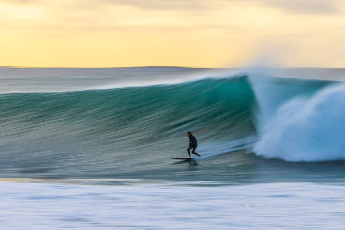
Pumping Friday (Aubrey Comben)
This week and weekend (Feb 7 - 12)
We're looking at an average week of surf, with winds due to remain poor following this morning's change as a ridge of high pressure moves in from the west.
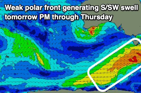
This will bring moderate to fresh S'ly winds into tomorrow (tiny chance for light W winds at dawn Surf Coast) with a mix of easing SW groundswell from today and building mid-period S/SW energy. The mid-period swell is being generated by a relatively weak but elongated polar front projecting north-east, up and across Tasmania this afternoon and evening, with a slim fetch of strong SW winds aimed through our swell window.

Sets to 3ft should continue across the Surf Coast all tomorrow, easing from 2-3ft on Wednesday with 4ft+ waves to the east.
Winds should ease into Wednesday morning but will remain light to moderate out of the S/SE. This will create bumpy workable winds for the keen on the beaches.
Winds will shift E-E/NE into Thursday morning, creating cleaner, peaky waves on the beaches to the east but with a small, fading S/SW swell from 2-3ft, 2ft on the Surf Coast.
Friday will become smaller and a trough looks to bring unfavourable SW winds. This will be a lay day.
Unfortunately there's nothing significant expected front or polar low wise through over the coming fortnight thanks to an increase in tropical activity off the East Coast and blocking high pressure sitting across Australian latitudes. Therefore make the most of this morning and hit the beaches before the swell drops out.


Comments
And the change is in..
Craig. Thanks for all your regular good work. T’was a nice spell of waves. A fortnight, geez that’s no good at all.AW.
Thursday sounds flat and Friday flatter with concave for Sat.
Charts calling 2-3ft beaches under easterly winds on sat..should I disregard this forecast craigos?
Yep, at this stage.
Bugger! Thanks mate
Is it too much to ask for at least another swell event of some form on the horizon?
I feel like this used to be a fairly common theme, yet these days, it's all or nothing.
It was a great few days, but the next week and a bit look void of anything - a man's not a camel!
Potentially is asking a bit much in Feb Stok... but the run we just had may have been the best for the last 12 months, I'm trying to think of another run that had 6 days of swell and offshores, with 3 proper sizey days in there, but nothing springs to mind.
Hopefully a taste of what's to come when autumn rolls around.
I enjoy both the love and hate for the author. Sometimes it feels like ppl are under the impression that the good surf (or lack of it) is created by swellnet
Kevchecksurf. I’m pretty sure theres no hate towards Craig. IMO he’s pretty much on the money most forecasts.
Back in the late 70’s early 80’s whilst studying, i managed to go on a school tour around the B.O.M office in Melbourne, one of the forecasters on duty was getting a little tired of the murmurs amongst us students where the general gutter trash was that the Staff never get the forecast correct. He turned around and said “I welcome anyone here today to tell me and others how an area of High pressure (High) or Cold pressure (Low) is going to behave, travel etc. “.
I’ve never spoke ill of them since. They do an amazing job just like the Swellnet boys. all good mate.AW.
No one here is that stupid.
But.....you could say that Swellnet are the froth overlords.
If the forecast terminology is embedded with terms such as pumping, polar low, very large, offshore all day etc. Or there's talk of best days/times to surf.
Then there's statewide froth. Victorian surfers lose their shit, and many of them will talk about how good it is.
Compare that with a more sneaker of a swell, or maybe a swell which peaks early or late, and somewhat flying under the radar.
Point is Swellnet is responsible for a portion of how the swell is perceived, hence, swellnet is in someway responsible for the swell being 'good' or 'bad'!!
Hence downplaying things mostly unless it looks absolutely epic. Rather be pleasantly surprised eh!
Ha, thanks guys! Definitely way more exciting creating the forecasts when there's a decent outlook!
No hate whatsoever to the craigos! The bloke is a deadset legend!
All hail king Craigos, he makes weather sexy! Except during long flat periods/SE air flows... then he can fuck off :)
Ha, thanks guys!