Fun weekend across exposed beaches, good swell Tuesday
Victoria Forecast by Craig Brokensha (issued Friday 6th October)
Best Days: Exposed beaches all weekend, Surf Coast and selected spots east of Melbourne Tuesday, east of Melbourne Wednesday
Recap
Easing surf with a swing in winds from the N'th to W favouring the exposed beaches to the east early and then Surf Coast reefs most of the day but with a bit less swell.
Today a deep surface trough has moved across us bringing strong onshore winds and a chunky S/SW windswell.
The surface trough is already moving off to the east and with this will see the swell ease through the day as winds also relax but remain fresh from the S'th.
This weekend and next week (Oct 7 - 13)
With the surface trough moving off to the east today and winds relaxing, the sizey windswell seen this morning will drop rapidly from this evening with not much size left tomorrow morning.
A new SW groundswell is due, generated the last couple of days by a thin but good pre-frontal W/NW fetch moving through our swell window.
Magnets on the Surf Coast should see 2-3ft sets tomorrow morning, easing through the day, back to a smaller less consistent 2ft Sunday.
The Mornington Peninsula should ease from 3-5ft, back to 3ft to occasionally 4ft on Sunday.
Winds will be best for the beaches tomorrow with an E/NE-NE breeze during the morning, likely giving into afternoon sea breezes. There is a chance winds will tend variable from the N'th as these troughs are always quite tricky and unpredictable.
Sunday will then be good on the beaches most of the day and reefs more so through the day with a N/NE tending light W/NW breeze as a front approaches from the west. The Mornington Peninsula will likely see winds just tend variable.
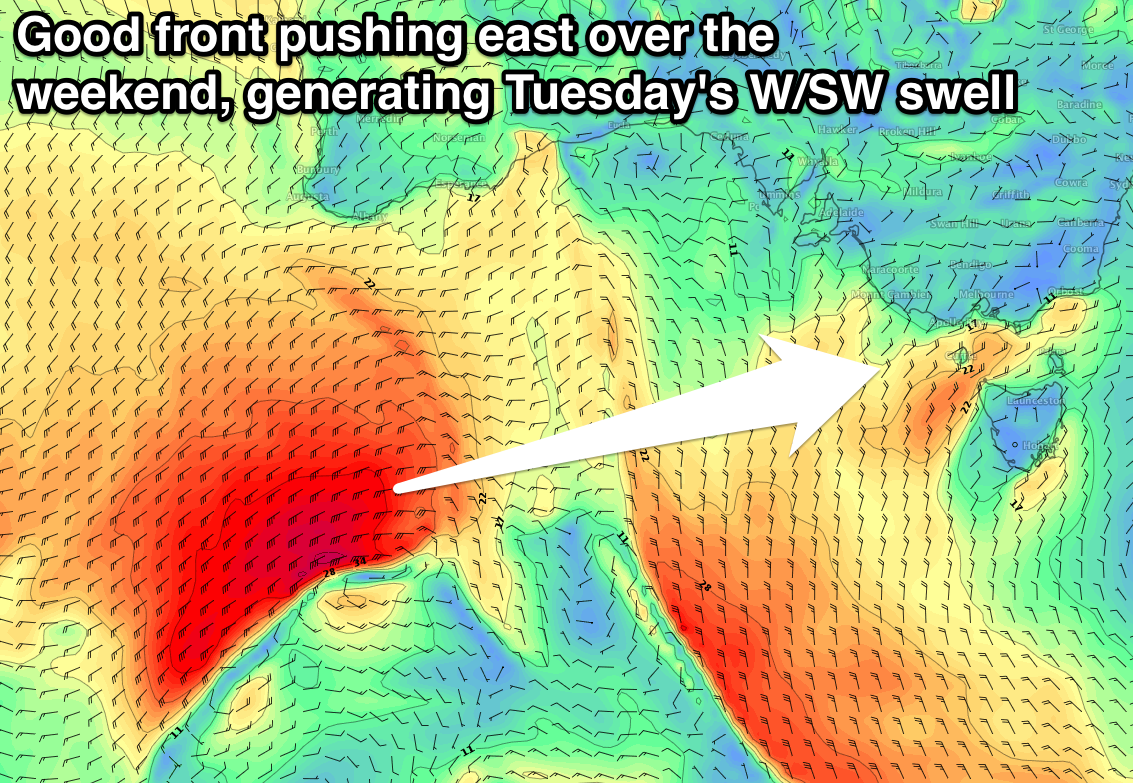
The surf will remain small into Monday with inconsistent 2ft waves across the Surf Coast (4ft Mornington Peninsula), but into the afternoon and more so Tuesday we should see a couple of new W/SW pulses filling in.
The first for Monday afternoon is being generated by a strong cold front that's projected from the Heard Island region towards WA yesterday and this morning. Sets to 2-3ft should be seen on the Surf Coast mid-late afternoon Monday with 4-5ft sets on the Mornington Peninsula though with W/NW tending W/SW winds.
 A secondary slightly stronger polar front following a similar track before passing under the Bight will continuing to generate a weakening fetch of strong to gale-force W/SW winds.
This will produce a better W/SW swell for Tuesday to 3ft to occasionally 4ft at magnets on the Surf Coast and 5-6ft on the Mornington Peninsula, easing into Wednesday.
Winds look as if they'll remain favourable for the Surf Coast Tuesday with a N/NW tending variable breeze, while selected locations east of Melbourne will also be clean.
Come Wednesday, N/NE winds will create great conditions across the beaches.
Longer term, mid-latitude fronts pushing through the Bight will generate some good W/SW swell late week and into next weekend but winds look to go funky in the wake of these fronts. More on this Monday. Have a great weekend!

