More active week of surf
Southern Tasmanian forecast by Craig Brokensha (issued Monday January 20th)
Best Days: Thursday morning, Friday morning, Saturday afternoon ahead of the change, Sunday morning, Monday morning
Features of the Forecast (tl;dr)
- Tiny tomorrow, similar Wed with strengthening SW-S/SW winds
- Small-mod sized mid-period SW swell Thu with N/NW winds ahead of sea breezes
- Easing surf Fri with NW tending SW winds
- Small-mod sized W/SW swell building Sat, peaking Sun, easing Mon
- NW tending W/NW winds Sat, then late SW
- W/NW tending strong SW-S/SW winds Sun
- NW tending SE winds Mon
Recap
The weekend offered small waves with clean conditions and tiny surf Saturday, a bit stronger Sunday but best early before winds really got into it by mid-morning.
Today the swell has faded with light winds and clean conditions which have persisted into this afternoon.
This week and weekend (Jan 21 - 26)
The coming days look tiny with tomorrow morning coming in clean under a variable breeze before gusty sea breezes kick in.
Wednesday will then be poor as a trough attached to a deepening low brings strong SW tending S/SW winds from dawn, but a new pulse of mid-period S/SW swell for later in the day is expected from the low, peaking Thursday.
An expanding fetch of strong SW winds should generate a small to moderate sized pulse of swell for Thursday morning to 2ft+, easing through the day.
Conditions look great on Thursday with a light N/NW offshore with sea breezes only popping up early afternoon.
Friday will be smaller but likely still 1ft to occasionally 2ft along with NW tending SW winds.

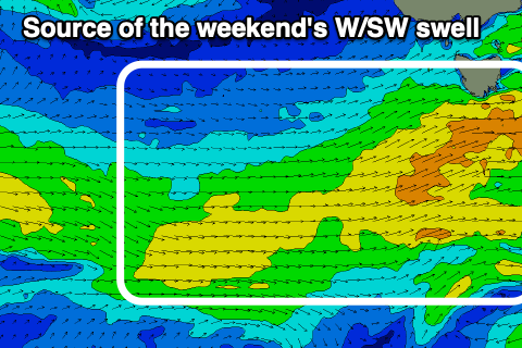
Now, into the weekend, fun levels of mid-period W/SW swell are due, generated by a healthy frontal progression moving in under the country mid-late week.
Fetches of sub-gale-force W-W/NW winds should generate small to moderate levels of mid-period W/SW swell for Saturday afternoon and Sunday morning.
Clifton should come in at 2ft+ but winds look dicey at the peak in energy.
NW tending W/NW then late W/SW winds are due on Saturday, strong W/SW tending SW winds Sunday, likely W/NW through the morning.
Monday looks nice and clean as the swell eases and then longer term we’ve got an active progression of swell generating fronts but they look distant and small from the west. More on this Wednesday.

