Nice waves on the way, just gotta get through the weekend
South Arm Surf Forecast by Ben Matson (issued Friday 8th September)
Features of the Forecast (tl;dr)
- Local storm surf on Saturday though nothing worthwhile
- Small and bumpy Sunday
- Good S/SW swell Monday with generally good conditions, holding into Tuesday but slowly easing
- Small and clean Wed/Thurs
Recap
Small surf Thursday building a little more today though only reaching 1-2ft, clean with offshore winds. A deep low is pushing through Bass Strait, strengthening winds about the region.
This weekend (Sep 9 - 10)
The large mid-latitude low currently pushing across northern Tasmania looks impressive on the synoptic charts however it's currently located outside of our swell window, and will only briefly develop any swell generating winds within the window overnight tonight. They'll be located close to the coast - and only last a short time - and so any surf we see will be short range windswell, accompanied with gusty onshore winds.
Therefore, the outlook for Saturday isn't great. Exposed beaches may build into the 3ft range but no major quality is expected.
Winds will remain gusty into Sunday but slowly ease, however the local windswell will concurrently abate and so surf prospects remain poor for the second half of the weekend too.
Next week (Sep 11 onwards)
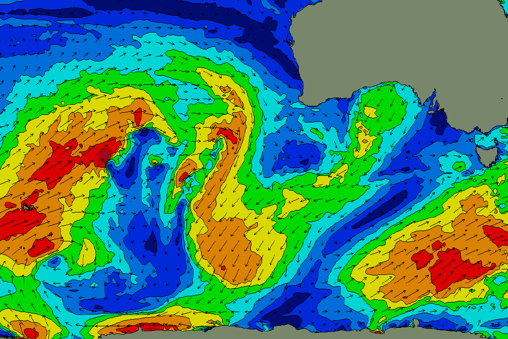
We've got some good waves on the way for early next week, with a new S/SW swell expected to fill in during the morning, building towards a broad peak in size from late afternoon through Tuesday morning.
This swell will have been generated by an interesting slow moving polar low currently skirting the ice shelf, which is expected to stall, broaden and intensify right on the eastern periphery of our swell window over the weekend (see below).

Nice fetch sitting below Tasmania on Sunday, that'll generate a decent S/SW swell for Mon/Tues
Swells from this source usually produce great results along the South Arm, owing to the more southerly direction, and at this stage we should see wave heights build into the 3-5ft range at most open beaches. The only risk is a potential westerly breeze at some point on Monday, but most of the day should see light NW winds and Tuesday is looking really good as the wind swings back to the north.
Expect size to steadily ease from Tuesday afternoon into Wednesday, bottoming out Thursday with very small options across the open beaches under a generally light and variable wind regime.
Beyond this, the long range surf outlook is a little fragmented, with an initially quiet Southern Indian Ocean expected to fire up mid-next week, but with a northern storm track through the Bight, which suggests swells with a lot more west in them than is ideal.
Nevertheless, it's looking like yet another active run of fronts into next weekend and beyond, and once the storm track shifts into a more favourable part of the South Arm's swell window, we'll see much more size potential throughout the state (i.e. during the following week).
More on this in Monday's update. Have a great weekend!

