Good swell later week with north-east winds
Southern Tasmanian Forecast by Craig Brokensha (issued Monday 3rd April)
Best Days: This afternoon, tomorrow morning and dawn Wednesday, Thursday and Friday selected spots, Monday morning
Features of the Forecast (tl;dr)
- Small background swell tomorrow and Wed with N/NW tending S/SE winds tomorrow, NW at dawn Wed ahead of a strong S/SW change mid-AM
- Moderate sized SW swell building later Wed, peaking Thu AM, easing into Fri
- N/NE tending stronger E/NE-NE winds on Thu
- Strong but easing NE-N/NE winds Fri
- Strong SW-S/SW winds Sat and Sun with a building S/SW windswell
- Easing swell Mon with W/NW tending SW winds
Recap
A strong swell on Saturday with clean conditions through the morning but not the most favourable tide. Yesterday was smaller but still really straight when cleanest in the morning.
Today the surf is hanging in at 1-2ft with clean conditions.
This week and weekend (Apr 4 - 9)
Small levels of background swell should hang in at 1ft to occasionally 2ft through tomorrow and Wednesday morning across CLifton and with morning N/NW winds ahead of S/SE sea breezes tomorrow, NW at dawn Wednesday ahead of a mid-morning S/SW change as a front clips us.

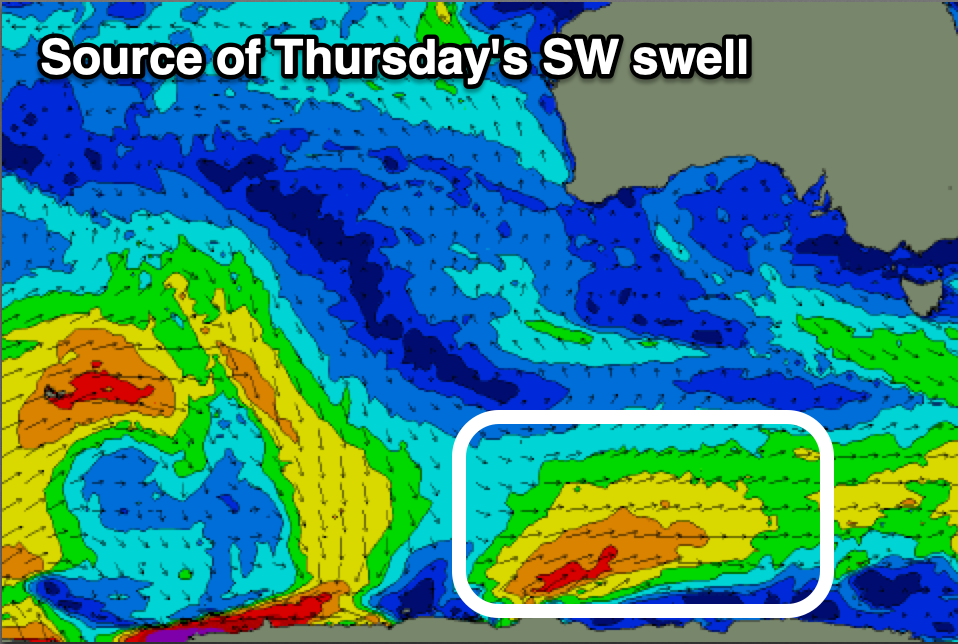
This front will generate a good pulse of mid-period SW swell for us though, arriving later Wednesday and peaking Thursday.
It’s currently south-west of us, generating a fetch of strong SW winds that will shift more W/SW on approach through today and tomorrow.
The swell looks mostly SW in direction as it peaks Thursday, swinging more S/SW through the easing trend on Friday.
Clifton should see 3ft sets Thursday morning, easing through the day but still 2ft+ on Friday.
Conditions will be favourable in selected spots with a N/NE tending gusty E/NE-NE wind tomorrow, then strong but easing N/NE-NE winds on Friday as a mid-latitude low moves in from the west

Unfortunately the low will bring strong SW-S/SW winds on Saturday when it moves across us, holding into Sunday morning.
Some new localised S/SW swell is due from this blow but with terrible conditions and sets to 3ft or so. Monday looks the best bet as winds shift back W/NW as the swell eases.
Longer term the Southern Ocean looks to become more active with a larger W/SW groundswell possible into the end of next week, but we’ll keep an eye on this and provide updates on Wednesday and Friday.

