Best Wednesday and then slow
Southern Tasmanian Surf Forecast by Craig Brokensha (issued Monday February 20th)
Best Days: Wednesday, Thursday beginners
Features of the Forecast (tl;dr)
- Moderate sized W/SW groundswell peaking this afternoon, easing steadily tomorrow with gusty SW winds
- Small, reinforcing mid-period SW swell for later tomorrow, easing Wed with N/NE tending strong E/NE winds
- Fading surf Thu with strengthening N/NE tending E/NE winds
- Tiny S/SE groundswell for Fri PM, easing Sat with gusty N/NE winds
Recap
Nothing of note on Saturday but yesterday, our fun sized mid-period W/SW swell came in at a good 2ft with favourable morning conditions.
This morning we fell temporarily in between swells but a strong W/SW groundswell has since kicked with 3ft sets across Clifton but with poor weather and onshore winds.

This week and weekend (Feb 21 - 26)
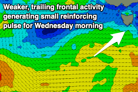
The 'bombing low' linked to the current building swell is racing quickly to the east and this will result in a quick spike and drop in swell this evening, easing back from 3-4ft tomorrow morning but with gusty SW winds as a weak trailing front pushes up and into us.

This will create some small, reinforcing mid-period SW swell that will ease back through Wednesday from 2ft to occasionally 3ft with a light N/NE offshore.
The afternoon will see strengthening E/NE winds as the swell continues to fade, 1-1.5ft on Thursday with strengthening N/NE tending E/NE winds.
The swell is due to bottom out Friday, with a small background S/SE swell possibly providing 1-1.5ft sets later in the day, easing Saturday with N/NE winds.
Longer term some small pulses of W/SW swell are on the cards but we'll have a closer look at this Wednesday.

