Plenty of swell, but poor winds
Southern Tasmanian Surf Forecast by Craig Brokensha (issued Monday January 2nd)
Best Days: Saturday
Features of the Forecast (tl;dr)
- Steady W/SW swell Tue with strong S/SW tending fresh S/SE winds
- New mid-period SW swell Wed with light-moderate S/SW tending S winds
- Easing surf Thu with freshening S winds
- Reinforcing mid-period swell Fri with S/SE winds
- Reinforcing SW swell Sat AM, then easing with N/NE tending strong E/NE winds
- Small W/SW groundswell next week with W/NW to SW winds
Recap
Unfortunately not much to see over the weekend with cleanish conditions each morning but surf to 1ft.
Today there's a bit more options but with lumpy conditions under less than favourable winds.
This week and weekend (Jan 3 - 8)
The coming period will be filled with fun swell pulses but locally winds will be average.
This afternoon's increase in inconsistent W/SW swell should be reinforced by another pulse tomorrow with infrequent 2ft sets on the exposed beaches.
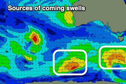
We should see a little better size and consistency through the late afternoon but more so Wednesday, with a secondary pulse for Friday, generated by weak, back to back lows moving through our swell window over the coming days.
These swells look to come more in around 2ft+ Wednesday morning and Friday morning, with smaller 1-2ft waves on Thursday.

Unfortunately a trough bringing today's strengthening onshore winds will leave lingering S/SW tending S/SE winds tomorrow, fresh to strong in strength.
Lighter but lingering S/SW winds are due on Wednesday creating bumpy conditions, freshening from the S'th on Thursday as the trough forms into a weak low east of us.
The low will start to push north late week, swinging winds S/SE, but still onshore with Saturday finally due to see winds swing back to the N/NE. This will be through the morning before strengthening into the afternoon.
One final polar front should keep 2ft waves hitting the coast on Saturday morning before easing into the afternoon and becoming tiny on Sunday.
Longer term we're looking at some small, inconsistent W/SW groundswell for next week but the source will sit a little too far north than ideal. Winds look to be westerly as the strong low linked to it pushes east, but more on this Wednesday.

