Winds continue to create tricky conditions
Southern Tasmanian Surf Forecast by Craig Brokensha (issued Wednesday November 16th)
Best Days: Dawn Thursday, Friday morning, Saturday morning, protected spots next Tuesday and Wednesday
Features of the Forecast (tl;dr)
- Moderate sized S/SE swell for today, easing slowly tomorrow with dawn W/NW winds, tending W/SW mid-morning, freshening and then tending SW and S
- W/NW tending S/SW then S/SE winds Fri with a fading S/SE swell
- New SW swell for later Thu, peaking Fri, with a reinforcing swell Sat AM, easing into the PM
- Fresh N/NE tending stronger NE winds Sat, light N tending strong W winds Sun
- Large S/SW-SW swell peaking Tue with strong W/SW winds
Recap
A solid, stormy mix of swells yesterday to 4ft with strong onshore winds, similar today with our new S/SE swell in the water.

Decent sized sets early this afternoon
This week and next (Nov 17 - 25)
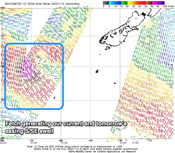
 The S/SW energy from yesterday is receding as moderate levels of S/SE swell impact the South Arm, generated by the low linked to the current cold wind and weather, stalling south-southeast of us yesterday.
A great fetch of strong to gale-force S/SE winds were generated, slowly weakening while aiming away from our swell window early this morning.
This will result in easing surf from a fun 3ft tomorrow morning, smaller into Friday and easing from 1-2ft.
A period of early W/NW winds are due at dawn tomorrow, though they'll quickly shift back to the W/SW mid-morning and then SW tending S/SW through the afternoon while being fresh in nature.
Friday looks cleaner with a light W/NW offshore, shifting S/SW mid-late morning ahead of S/SE sea breezes.
As touched on in Monday's notes, also in the mix on Friday will be some fun SW groundswell, generated by a strong polar low to the south-west of Western Australia Monday. A fetch of NW gales should produce 2ft sets, while a trailing fetch of SW tending W/SW winds on the backside of the low is likely to maintain 2ft sets Saturday morning, fading Sunday.
Surf early Saturday as a fresh N/NE wind will strengthen from the NE through the late morning, creating deteriorating, choppy waves across Clifton.
 Sunday will be clean but likely tiny.
Now, moving into next week, a strong cold outbreak is due to fire up to our south-west, moving across us early next week, bringing strong SW winds and a moderate sized + increase in SW-S/SW swell. The local winds and conditions look a bit average at the peak of the swell (Tuesday) with W/SW breezes, cleaner in protected spots Wednesday with easing size.
There's still some room for movement regarding the timing, direction and size of the swell, so check back here Friday for a clearer idea.

