Good week of waves
Southern Tasmanian Surf Forecast by Craig Brokensha (issued Monday December 20th)
Best Days: Tomorrow, Wednesday morning, Thursday morning, Friday morning
Features of the Forecast (tl;dr)
- Moderate sized W/SW swell tomorrow with NW tending fresher W/NW winds
- Larger mix of swells Wed with fresh W/NW tending strong W/SW-SW winds
- Easing mix of swells Thu with W/NW tending S/SE winds
- Fading surf Fri with N/NE tending SE winds
Recap
Clean, tiny waves on Saturday while a new, inconsistent W/SW groundswell due yesterday only provided 1ft sets, under the expected 2ft. Today conditions have remained tiny unfortunately with a new W'ly swell not quite performing. Cape Sorell has since risen so there should be a bit more swell this afternoon.
This week and weekend (Dec 21 - 26)
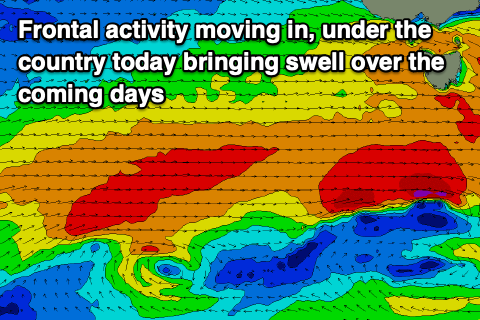
Currently a vigorous frontal progression is moving across us with W'ly gales being produced to the south-west of and under the state.
This should be bringing an increase in windy swell this afternoon with tomorrow due to come in around the 2-3ft range.
 Continued W/SW winds and frontal activity through tomorrow will likely bring a bit more size on Wednesday along with some additional W/SW groundswell from a strong polar low that formed south-west of Western Australia yesterday. This generated a fetch of gale to severe-gale winds and we should see the size pushing to the 4ft range across Clifton on Wednesday, easing from 3-4ft on Thursday morning.
Winds will be favourable tomorrow morning and from the NW, shifting W/NW through the day and holding into the evening. W/NW tending W/SW-SW winds are then due on Wednesday with W/NW offshores Thursday morning ahead of S/SE sea breezes.
The surf will become much smaller Friday, fading from 1-2ft but with favourable N/NW tending S/SW winds again.
As we move into the weekend we're due to see some weaker but favourable polar frontal activity firing up under us again, generating some fun swell for Sunday/Monday. There may even be some further follow up energy mid-week.
Winds won't be as favourable with a general SW flow across the state (clean early) but we'll have a closer look at this Wednesday.

