Increasing activity next week
Southern Tasmania Surf Forecast by Craig Brokensha (issued Friday 29th May)
Best Days: Saturday from mid-late morning, Tuesday onwards
Recap
Tiny surf yesterday, even smaller today.
This week and weekend (May 30 – Jun 5)
Our small spike of flukey SW swell for tomorrow is just on track. Don't expect anything early, but into the late morning - afternoon a small 1-2ft waves is likely.
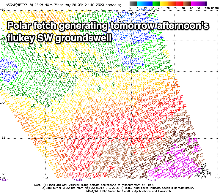
 The source of the swell was a poorly tracking, slim fetch of gale to severe-gale W/SW winds around a polar low last night south-west of us.
Satellite observations were favourable and picked up 30-40kt+ barbs so we'll hopefully see 2ft sets into the afternoon, though tiny back into Sunday.
Fresh and gusty N/NE winds will favour selected spots tomorrow, N/NW all day Sunday.
Our increasing activity into next week is still on track, with a tricky and flukey initial mid-latitude frontal system expected to drop south-east into our swell window on Sunday.
A small fetch of strong W/SW winds is likely to generate a tiny W/SW swell for later Monday but more so Tuesday morning though only to 1-1.5ft or so.
 Of greater significance are stronger and better aligned polar storms firing up on its tail. The first will project a fetch of strong to gale-force W/SW winds through our swell window Sunday evening and Monday, kicking up a new W/SW swell for Tuesday afternoon, reaching 2ft+.
Behind this a fetch of storm-force W/SW winds will project east-northeast and then north-east ideally through our swell window, generating a large, long-period SW groundswell for Wednesday.
At this stage it looks to be around 4-6ft or so but with strong SW tending S/SW winds, clean as it eases Thursday. Check back here on Monday for more on this though. Have a great weekend!

