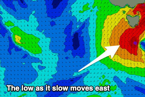
Cold, wet and windy low incoming
Southern Tasmania Surf Forecast by Craig Brokensha (issued Wednesday 29th April)
Best Days: Friday afternoon, Saturday, Sunday, Monday morning
Recap
Easing clean surf yesterday, tiny today and hanging in at 1-2ft.
This week and weekend (Apr 30 – May 3)
Tomorrow will remain tiny, but then we look at the evolution of a deep, powerful and cold low that's due to form west of us this evening.
The models have come mostly into alignment regarding the position, movement and speed of the low, but EC is a touch weaker in strength than GFS (which powers out forecast models).
So taking this into account, shave a touch of size off what the charts are showing now to be conservative.
 During tomorrow the low will sit west of our swell window, but to our south, an infeed of SE gales should produce a new S'ly groundswell that's expected to build Friday, tiny in the morning but likely reaching 3ft or so by dark if we're lucky.
Winds look favourable and offshore from the N/NW, with a possibly SW change on dark aas the low then starts moving east.
This is when we'll see the real action take place.
The models are forecasting a fetch of S/SW gales will develop in our swell window Friday afternoon but move into us Saturday morning, kicking up a rapid increase in windswell and groundswell, building to 5-6ft through the afternoon across Clifton, smaller and 3-4ft or so early.
The low is then forecast to move slowly east Sunday, resulting in a drop in size from 4-6ft out of the S'th, small Monday.
Winds will accordingly be strong from the W/SW tending SW Saturday and SW all day Sunday with a bit less strength, lighter W'ly Monday morning.
Beyond this there's nothing to exciting on the cards for us, but more on this Friday.

