Small swells ahead of a good S/SE groundswell
Southern Tasmania Surf Forecast by Craig Brokensha (issued Wednesday 23rd January)
Best Days: Thursday morning, Friday, Sunday, Monday morning, Tuesday
Recap
Easing surf with funky winds yesterday, poor today with a stronger onshore wind and small average swell.
Today’s Forecaster Notes are brought to you by Rip Curl
This week and weekend (Jan 24 - 27)
The change linked to today's onshore winds has generated a small weak mid-period S/SW swell, with it due to ease back from 1-2ft tomorrow morning. Winds will improve but be N-N/NE tomorrow morning, favouring the other end of Clifton before freshening into the afternoon out of the NE.
Into Friday some new mid-period SW swell is due to fill in, with a secondary less consistent pulse for later Saturday, generated by an elongated fetch of pre-frontal W/NW winds and stronger post-frontal W/SW gales.
Friday should come in at 1-2ft with similar sized sets through Saturday, but a stronger S/SE groundswell will take its place into the afternoon and Sunday.
Coming back to the winds Friday though and a gusty N'ly wind will swing more NW through the day ahead of a weak W'ly change.
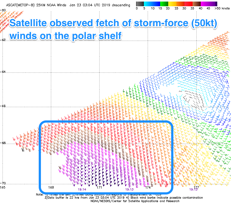
 Saturday's S/SE groundswell has been upgraded a little since Monday. Currently a great but small and tight fetch of storm-force S/SE winds are being aimed towards us, south of New Zealand. The fetch will extend in length with weaker S/SE gales projected closer towards us this afternoon and evening before the low generating the swell starts to push east tomorrow and swings winds out of our swell window.
A long-period S/SE groundswell will be generated, with it arriving Saturday morning and building to a strong 3-4ft into the late afternoon across Clifton but a W/SW tending SE breeze will create bumpy conditions.
Sunday looks cleaner as the swell starts to ease from 3ft to maybe 4ft under a N/NW offshore, tending W/NW into the afternoon, smaller and to 1-2ft Monday.
Into next week a series of back to back mid-latitude frontal systems will push south of the Bight and then down across us, mostly too north of our swell window.
We may see a small 1-2ft wave on Tuesday from the strongest front, but more on this Friday.

