Large though mostly onshore swell tomorrow, cleaner and easing from Friday
Southern Tasmania Surf Forecast by Craig Brokensha (issued Wednesday 3rd October)
Best Days: Protected spots tomorrow, Friday morning, Saturday morning, Sunday morning
Recap
A drop in swell back to 2-3ft yesterday morning but with lumpy conditions owing to a variable wind before fresher sea breezes kicked in.
Our new SW groundswell expected today has come in on forecast with strong 3-4ft sets across Clifton with a light offshore wind.
Today’s Forecaster Notes are brought to you by Rip Curl
This week and weekend (Oct 4 – 7)
Our large and powerful long-period SW groundswell for tomorrow is still on track, but so are the poor onshore winds.
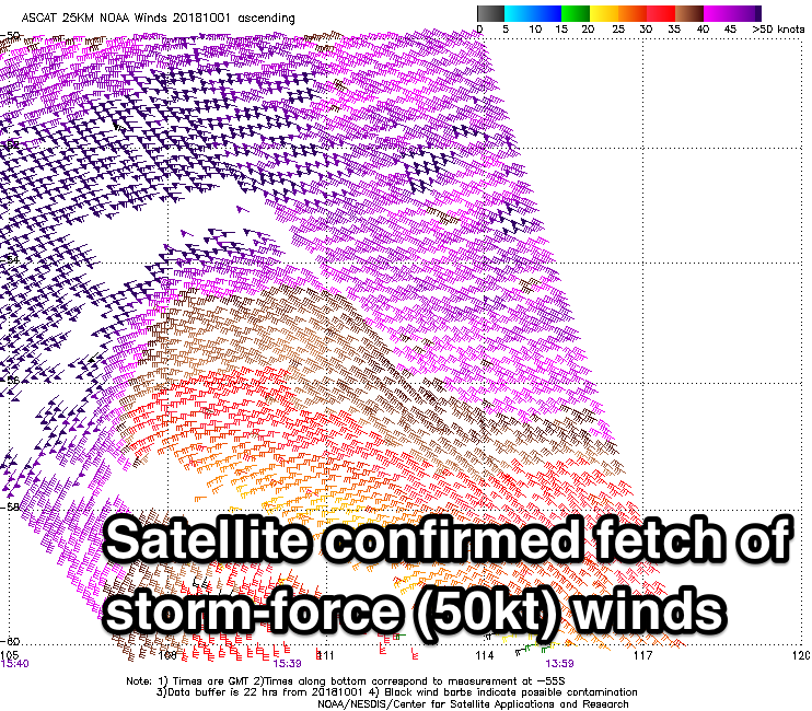
Satellite observations have confirmed a very impressive pre-frontal fetch of severe-gale W/NW winds and post-frontal storm-force W/SW winds in our swell window yesterday and today.

This groundswell may be seen building on dark today, but a peak in size is expected tomorrow morning to a large powerful 5-6ft on the sets across Clifton, easing back through the day and then smaller from 3-4ft Friday.
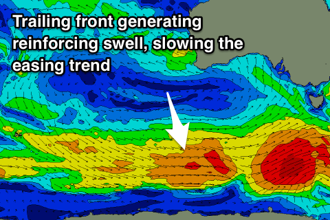
The easing trend will be slowed by a reinforcing SW swell arriving Friday from a trailing fetch of W'ly gales behind the severe-low linked to tomorrow large swell.
 Winds are the main issue, with a SW tending S/SW breeze due tomorrow, possibly light from the W/NW at dawn, with Friday seeing light W/NW-NW winds before sea breezes kick in.
Saturday looks smaller with easing 2-3ft sets and a morning NW offshore ahead of SE sea breezes.
A new pulse of SW groundswell is expected on Sunday, but the size and strength of this swell has been downgraded with the polar front moving in and generating it not being as well aligned or as strong.
We'll see a pre-frontal fetch of strong to gale-force W/NW winds, followed by a burst of pre-frontal W/SW gales late in our swell window.
Size wise we're looking at a building swell back to 2-3ft through Sunday, easing from a similar size Monday morning but with dicey winds owing to a Tasman Low sitting to our north-east.
Sunday morning should be clean ahead of SE sea breezes, with the low possibly directing a weaker SE'ly into us Monday morning. We'll review this Friday.
Longer term we're looking at a possible cold front pushing up from below us and past the south-east corner of the state, bringing a S/SW swell mid-next week but with onshore winds. We'll have another look at this Friday so check back then for an update.

