Large clean swell easing through tomorrow
Southern Tasmania Surf Forecast by Craig Brokensha (issued Friday 16th February)
Best Days: Saturday
Recap
A good fun W/SW swell yesterday in the 2ft range with the odd bigger one at more exposed breaks, while today we've got some new swell on the build.
The surf was around 2-3ft this morning, but a strong low to our south should produce a bigger pulse later today, explained below.
Today’s Forecaster Notes are brought to you by Rip Curl
This weekend (Feb 17 – 23)
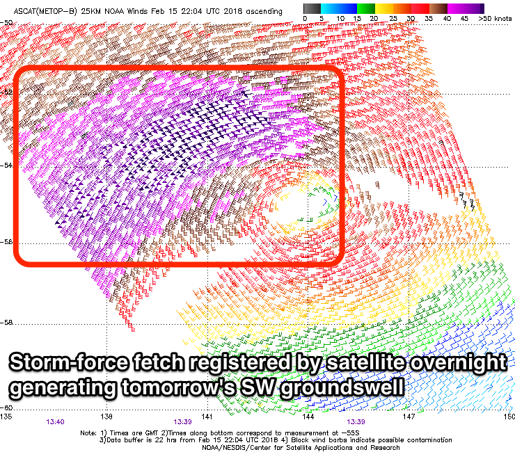
Last night a deep and powerful polar low generated a great fetch of severe-gale to storm-force SW winds through our southern swell window.
This morning the low has projected a weakening fetch of similar strength winds north-east through our swell window, producing a large SW groundswell that should kick later today and more so this evening, peaking early tomorrow morning.
We're looking at strong 4ft sets across Clifton, bigger at more exposed breaks, easing rapidly through the day, with excellent conditions under a fresh N/NW tending NW and then W/NW breeze.
 Sunday will then be poor with onshore SW-W/SW winds and a much smaller leftover swell to 2ft.
Later in the day though, some new SW groundswell is expected, peaking Monday morning.
This is being generated by a weaker polar front that's formed well south of WA and will project a small fetch of strong to gale-force W/SW winds through our south-western swell window tomorrow and Sunday morning.
The swell should kick later Sunday to 2ft to occasionally 3ft, coming in a similar size Monday morning but with lingering S'ly winds in the wake of the front generating it.
Tuesday looks poor as the swell eases as well with SE tending E winds.
Longer term there's nothing significant on the cards so make the most of tomorrow's swell. Have a great weekend!

