Fun S/SE groundswell Friday but onshore, with a better swell next week
Southern Tasmania Surf Forecast by Craig Brokensha (issued Wednesday 7th February)
Best Days: No good days until next week
Recap
Yesterday's secondary pulse of S/SW groundswell came in above forecast with strong 3ft sets reported across Clifton, fading back from 1-1.5ft this morning.
Today’s Forecaster Notes are brought to you by Rip Curl
This week and weekend (Feb 8 - 11)
Tomorrow will start tiny but later in the day and more so Friday a good S/SE groundswell is due, though spoilt by local winds.
This swell has been generated the past couple of days by a fetch of gale to severe-gale S/SE winds on the polar shelf, south of New Zealand.
 We should see it peaking Friday to 2ft at Clifton, bigger at more exposed breaks, but a surface trough moving in from the west will bring onshore S/SW tending SE winds.
Saturday will be clean with a NW offshore but the swell is due to fade from a tiny 1-1.5ft.
Into Sunday a small W/SW swell is expected across the coast, but the fetch generating this was distant and weak, with only 1-1.5ft sets due and what looks to be onshore SW winds.
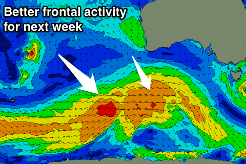
Of greater importance is a strong frontal progression that's forecast to develop in our swell window through the weekend and early next week, generating some good W/SW groundswell mid-next week, but more on this Friday.

