Windy swells over the weekend, easing ahead of a new swell Wednesday
Southern Tasmania Surf Forecast by Craig Brokensha (issued Friday 20th October)
Best Days: Saturday protected spots, Monday morning, Wednesday morning
Recap
No surf the last few days with tiny clean waves.
This weekend and next week (Oct 21 - 27)
A strong frontal system that's currently pushing in and under us has been generated a good fetch of pre-frontal W/NW gales through our western swell window, straightening out from the W during this afternoon and evening.
 We should see some good W/SW swell to 2ft off this system, while a secondary weaker front pushing in and under us Saturday evening, followed by a third Sunday should keep 2ft sets humming along Sunday, easing from 1-2ft Monday.
Winds tomorrow should be from the W/NW during the morning, holding from the W into the afternoon, while Sunday still looks poor with the front passing through bringing W/SW tending SW breezes. Offshores are due to return Monday morning out of the W/NW, tending W/SW late morning.
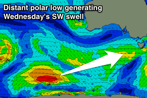
As touched on last update, longer term we've got a fun SW groundswell due Wednesday, generated by a distant and slow moving polar low forming south-west of WA, creeping east while weakening over the weekend.
This swell should provide inconsistent 2ft sets on Wednesday when it fills in with morning offshore winds and afternoon sea breezes.
Longer term there's nothing to major on the cards, but more on this Monday. Have a great weekend!

