Fun amounts of swell with workable winds
Southern Tasmania Surf Forecast by Craig Brokensha (issued Monday 20th April)
Best Days: Midday Thursday onwards, Friday morning, Sunday
Recap
Yesterday's reinforcing W'ly swell came in better than expected with 2-3ft sets across Clifton with favourable winds through the morning. The swell faded overnight though with smaller 1-2ft sets into today.
This week (Apr 23 - 24)
Tomorrow's swell is still on track and the models are picking a lot more size than I'm expecting off the strong but unfavourably tracking polar front that formed south-west of WA earlier in the week.
With this in mind and their good performance across the South Arm, I've upgraded the size due off this swell to 2-3ft across Clifton into the afternoon. The morning will be tiny and this is when winds will be best and variable (light from the N'th) before swinging moderate E/NE into the afternoon.
A drop in size is then due Friday from 2ft+ under N/NW tending E/NE breezes again.

This weekend onwards (Apr 25 onwards)
A further drop in size is due Saturday across the coast but winds look poor with a surface trough moving in from the west, bringing a gusty S/SE change.
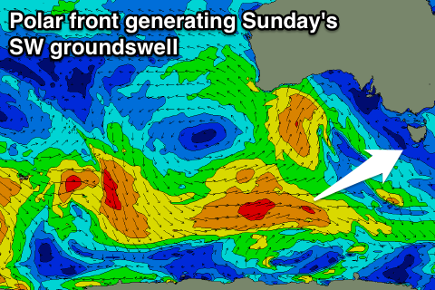
A new swell is due into Sunday to the 2ft+ range, generated by a strong polar low pushing along the Antarctic Shelf over the coming days and it looks like we'll see NW winds most of the day ahead of a late SW change.
Another cold front pushing in from the west over the weekend is expected to generate a similar 2ft of W/SW swell for Monday but winds may linger onshore still in the wake of later Sunday/s change. We'll confirm this Friday.
Longer term we should see some polar fronts skirting around the base of a strong high to our west, generating small pulses of SW groundswell, but more on this Friday.

