Windy and punchy from the south, then back to small fun swells for the open beaches

South-east Queensland and Northern NSW Surf Forecast by Ben Matson (issued Mon 17th Mar)
Features of the Forecast (tl;dr)
- Solid, windy but easing S'ly swell in NNSW Tues (light winds south from Coffs)
- Much smaller in SE Qld
- Better conditions at most coasts from Wed onwards with smaller surf
- Minor E'ly swell building Wed/Thurs, easing Fri
- Small flukey S swell later Thurs/Fri
- Not much this weekend, or next week (at this stage)
Recap
Small leftover E’ly swells provided 2ft sets to most open beaches north from Coffs on Saturday, Sunday and Monday. A minor south swell also favoured south swell magnets in Northern NSW with small waves at times. A gusty southerly change pushed across the Mid North Coast early this morning, reaching SE Qld after lunch, and we’re now seeing building south swells across the region.
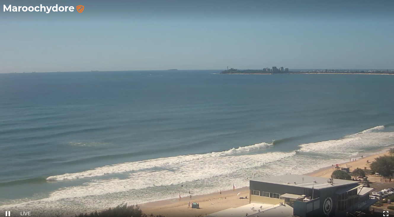
Fun small beachies across the Sunny Coast this morning
This week (Mar 18 - 21)
The front responsible for today’s cool change isn’t really that beneficial for our immediate surf prospects.
Sure, we’ll see a solid south swell build overnight but it’ll be accompanied by gusty winds, and sheltered spots will be significantly smaller, of which SE Qld really won’t see a great deal of love (in the size department) at all.
Adding to that is the unknown, patchy state of the sand across the region in the wake of TC Alfred. So, overall the surf potential is a bit of a wild card at the moment.
So, Tuesday can expect a slow drop in south swell with persistent S/SE winds north from Yamba (lighter with morning SW breezes south from Coffs). South facing beaches in Northern NSW should pick up 4-5ft+ sets early - though they’ll be pretty ragged on the surface - with much smaller conditions elsewhere owing to the swell direction.
SE Qld doesn’t really enjoy these swell directions much, so across the Gold and Sunshine Coasts we’ll see generally small waves at the semi-exposed points in the 1-2ft range, with exposed northern ends pushing 3ft+ at times, again, with poor conditions under the S/SE breeze.
Much better conditions are expected from Wednesday onwards as a small surface trough off the Northern Qld coast and a high pressure ridge in the northern Tasman Sea creates light easterlies across most coasts, with a chance for brief morning offshores. The Sunshine Coast and the lower Mid North Coast are the outliers here, as they’ll be closer to each pressure gradient source, and may continue to see a little more strength in the synoptic flow. But overall, it’ll be an improvement.
Surf size will ease slowly into Wednesday (2-3ft across Northern NSW, a little smaller across open beaches in SE Qld), however the ridge through the Northern Tasman Sea should build a small easterly trade swell across SE Qld and Northern NSW later Wednesday and into Thursday.
With generally light winds there should be some fun beachies around somewhere north of 2ft to maybe 2-3ft. Expect smaller surf south from about Yamba.
Surf size will then slowly ease through Friday with similar conditions.
However, it’ll also be worth keeping an eye out for a small south swell due later Thursday and Friday across Northern NSW, generated by a distant, poorly aligned frontal system in the Southern Ocean at the moment. No major size is expected and there’ll be long breaks between the sets, but south facing beaches south of Byron could pick up stray 2ft+ sets.
This weekend (Mar 22 - 23)
Looks like a small weekend of small flukey swells and light variable winds.
The mid-week trade swell will linger across open beaches both days with slow 1-2ft sets, and small long period south swells may also grace the Northern NSW region at times, though again no more than a couple of feet tops (and very inconsistent).
A weak high pressure system over the coast should maintain light winds and clean conditions.
Next week (Mar 24 onwards)
There’s nothing significant on the charts for next week, so we’ll have to wait and see what Wednesday’s update brings.
See you Wednesday!