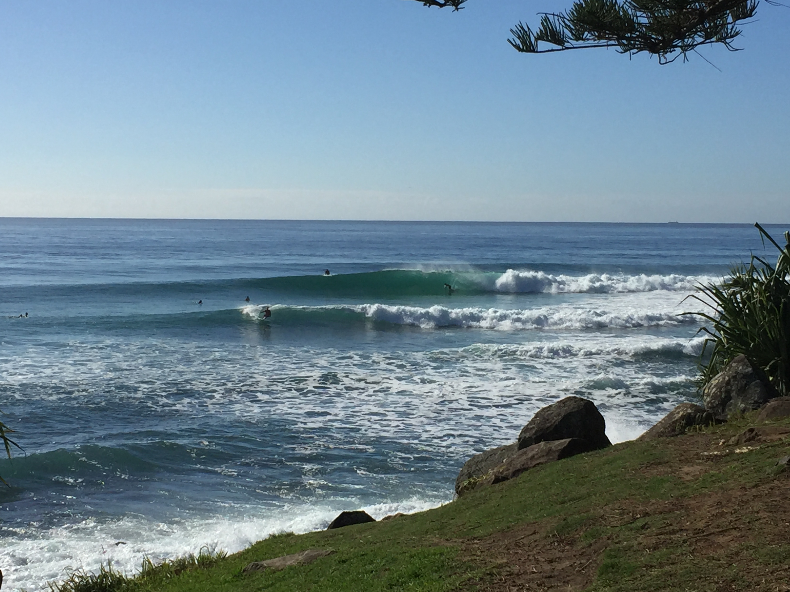
Fun weekend for the beachbreaks
South-east Queensland and Northern NSW Surf Forecast by Ben Matson (issued Friday 26th May)
Best Days: Sat/Sun: small, very inconsistent but fun E'ly swell with good winds in most areas.
Recap: An intermittent but otherwise super clean and very fun E’ly swell has provided plenty of fun waves over the last few days, around 2-3ft on Thursday and occasionally bigger around 3ft+ today - though the extremely long breaks between sets could have been perhaps a little more reiterated in Wednesday's notes. A small south swell also made its way up the Northern NSW coast later Thursday and into today though was smaller than the pre-existing E’ly swell. Conditions have been excellent with light variable winds.

Burleigh this morning, inconsistent but super fun
This weekend (Sat 27th - Sun 28th)
There are no new swell sources in the water for the next few days, so we can expect a continuation of this extremely inconsistent but otherwise fun E’ly swell over the weekend, sourced from a distant, retreating fetch in the South Pacific south of Fiji earlier in the week.
A minor embedded pulse is likely either later Saturday or early Sunday, which may briefly increase the frequency of sets waves, but otherwise expect extremely long breaks between the bigger waves, up to 3ft+ at times at reliable swell magnets and 2-3ft at most open beaches. Between sets it’s likely to be tiny to flat at times so you’ll need to be very patient. Sunday should see a slight decrease in size throughout the day.
Light variable winds are expected for most coasts on Saturday, and should persist across SE Qld and Far Northern NSW into Sunday. The Mid North Coast may see freshening S’ly tending NW winds on Sunday but I don’t think this will impact surf quality too much.
Next week (Mon 29th onwards)
A front exiting eastern Bass Strait on Sunday will generate a flukey, directional south swell for Monday afternoon and early Tuesday across Northern NSW. It’ll mainly bypass most coasts but a handful of reliable south swell magnets south of Byron Bay could pick up occasional 2ft to perhaps 2-3ft sets.
Elsewhere, expect easing, very inconsistent and very small leftover E’ly swell from the South Pacific, up to 2ft+ early Monday and becoming smaller through the rest of the period. Between sets it'll be tiny to flat.
Small, residual energy will prevail through the remainder of Tuesday and Wednesday ahead of a gusty southerly change that could spawn a mid-week Tasman Low. The models are quite divergent on this scenario so we’ll need a few more days to iron things out but at this stage it’s looking like a windy, sizeable middle to latter part of next week for some parts of the East Coast, mainly Northern NSW.
The big question at the moment is whether our mid-week system will be placed in the central/southern Tasman Sea (favouring southern NSW) or central/northern Tasman Sea (favouring Northern NSW). It’s simply too early too have any confidence in either scenario. I'll update in the notes over the weekend as more information comes to hand.
Have a great weekend, see you Monday!


Comments
Plenty of fun waves on the northern Goldy beaches, this looks around 3ft+.
Looking tasty on the Tweed this morning too.
Ps Burleigh looks GR8!
Goldy beachies on fire this morning!
Stacked lines.. and still empty!
Not quite as good as it looks on the NGC... high tide and inconsistency spoiled the party. Banks are still A1 though!
Has anyone else noticed any issues with the forecast model? Seems not to be updating and only showing 8 days.
Still some small clean lines on the Tweed.. long waits for sets though!
Whales are here. A cpl right in close too.